Nariyn Golyn Els: the frozen desert (3/3)

Interpretation of the logger’s graph (using TempCentre software)


The temperature curve of the 7 days/ 8 nights research period. The device was registering a value every 10 minutes. The time zone in the graph is UTC+2, as I uploaded the PDF file at home in Romania. You must consider another 6 hours to reach the mongolian time zone (UTC+8). So the real research period was: 2018.01.17 16:43 – 2018.01.25 10:03 


Post factum I found out that the effectiveness of the home-built radiation shield was not satisfactory, therefore I will analyse only the intervals when the logger wasn’t exposed to the direct sunshine. This means to skip approximately the 11 AM – 4 PM period (5 AM – 10 AM on the diagram above, because of the 6 hour time difference).


First night (17-18 January)

The temperature was decreasing fast in the evening between 7:13 PM – 9:23 PM, from -19.2 to -30.6 degrees Celsius. After this it was a short warming up to 10:33 PM when it reached -28.0 degrees. Around this time I was outside my tent and have seen no clouds on the sky. Also it was a complete lack of wind at the bottom of the hollow and only ocasionally some mild air movements on the rim. Between 10:33 PM – 1:53 AM the temperature have plummeted fast again and have reached -36.0 degrees, which is the lowest temperature for the entire night. From here to 4:43 AM it was an abrupt and significant warming period when the temperature have climbed to -18.6 degrees. I haven’t observed an appreciable cloud coverage or more than light air movements at my tent in this period too, however as I have watched the sky only a few times, I can’t exclude a temporary altocumulus invasion. I have seen these types of clouds present on the sky, but were always occupying way less then one half of the total part. After 5:13 AM the temperature have decreased fast again and have reached a secondary minimum of -33.0 degrees at 9:53 AM. I was present at the bottom of the hollow from around 8:30 AM until some minutes after 9 AM and have seen the sky partially covered by cirrus and thin altocumulus clouds. On the graph there is a short warming of 1-2 degrees which coincides exactly with the period when I was there and have checked the logger, so this lil temperature change was probably caused by my influence. Shortly after 9 AM I left the depression and have returned only in 21 January in the afternoon.

Second night (18-19 January)

The graph’s curve plummeted to -33.4 degrees Celsius at 7 PM. This will remain the lowest temperature for the entire night, as from here starts a considerable and long warming period with more abrupt fluctuations, reaching a maximum of -20.0 degrees at 6:23 AM. Then the temperature decreases fast until 8:43 AM when it reaches a secondary minimum of -32.4 degrees. The following short warming increases the temperature to -26.5 degrees at 9:33 AM, but then plummets back to -31.3 degrees at 10:53 AM. Around this time reaches the sunshine first the bowl’s bottom, therefore the 10:43-10:53 period always marks the start of an abrupt temperature rising (valid for all research days).
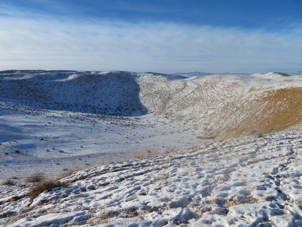
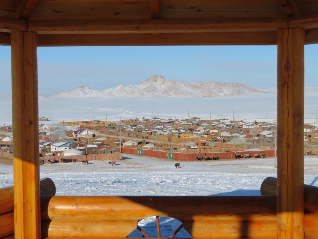
These first 2 nights have a less regular temperature curve with some striking and considerable warming sections. As I haven’t observed any semnificative cloud coverage (outside cirrostratus) in this period, I suspect that the major cause of these abrupt night fluctuations are rather air movements/ mixing than overcasting. My residence in Erdenekhairkhan was quite close to the research camp (less than 20 km in direct line) so even in the days when I wasn’t present I could appreciate pretty well the general conditions of the sky above.

Third night (19-20 January)

In the afternoon the temperature started an abrupt drop which continues into the late evening when it reaches -39.5 degrees at 10:43 PM, the lowest temperature for the entire night. From here the curve became atypical but without semnificative changings, fluctuating between -36.5 degrees and -39.3 degrees during the entire night period.

Fourth night (20-21 January)

In the late afternoon and early evening hours the temperature decreases abruptly to -36.1 degrees at 7:13 PM. From there is a one hour intense warming to -31.3 degrees than the temperature will start to fall again and (with some smaller fluctuations) will reach a minimum of -43.8 degrees at 8:53 AM, the lowest for this night.

 Fifth night (21-22 January)

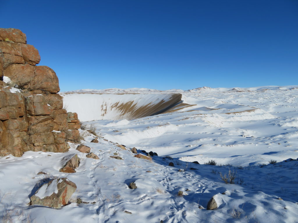
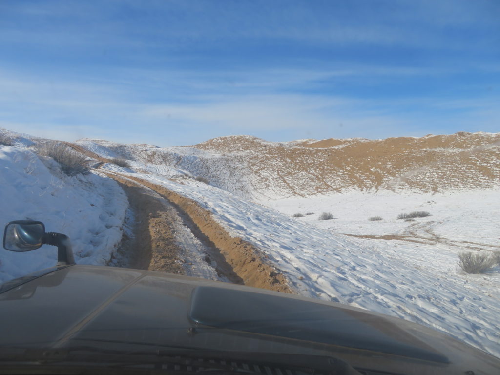
After 3 PM I reached the frost hollow’s bottom again.
In the morning of 21 the sky was partially covered by cirrus clouds and this setting will continue to define the entire day. From the afternoon to the early evening there is an abrupt drop when the temperature reaches -40.9 degrees at 7:43 PM. Then follows a significant 1.5 hours warming when it climbs to -31.3 degrees at 9:13 PM. That’s almost 10 degrees. Shortly afterwards the drop continues again and reaches the lowest temperature of this night at 5:43 AM: -46.7 degrees Celsius. From there the curve is atypical but with smaller fluctuations, remaining in the morning hours between -44.7 and -45.9 degrees. I was present at the hollow’s bottom during the morning between 8:40 and 9:45 AM and I was checking the logger just before leaving. This coincides exactly with the sharp leap on the graph when the temperature rises to -37.9 degrees at 9:43 AM. This peaky segment was definetely caused by my intervention. In the morning the sky was partially covered by cirrus and cirrostratus clouds. In the night before I haven’t observed clouds at any time when I was outside my tent. (Note: Thin cirrus clouds are not visible at night, especially without moon.) I had left the camp on this day after 11:30 AM and will return here 2 days later, in the afternoon of 24 January.

Sixth night (22-23 January)

From the afternoon there is a very abrupt and significant decreasing of the temperature up to 1:13 AM when it will reach -49.5 degrees, the night’s minimum. From here the night’s curve became atypical but without big differences, fluctuating between -46.5 and -48.4 degrees in the second part of the night, respectively the morning hours.

Seventh night (23-24 January)

After 3:43 PM the temperature starts to drop abruptly and continues to drop quite strong even in the middle and second part of the night. I consider this night curve the closest to the ideal one between all 8 cases. At the same time it had also reached the absolute lowest temperature of the entire research period: -53.0 degrees at 8:33 AM. Outside 21 January it is the single day when the minimum temperature was registered in the dawn period, when a night minimum normally is expected to occur.


The lowest point of the temperature curve. Add +6 hours to obtain the correct local time: 8:33 AM

Eighth (last) night (24-25 January)

This day was the clearest and also the calmest between all eight days, therefore the temperature curves are the most representative for a frost hollow in ideal conditions. I have not seen any clouds on the sky during the entire day, not even thin cirruses. The night was full of stars, without any air movement. The sharp temperature drop what started in the afternoon continued until the first part of the night when at 1:53 AM have reached the night’s minimum, -50.3 degrees. From here there will be very small changes during the remaining part of the night and the following morning hours. This part of the graph is close to an isotherm. As the highest registered value between 12 AM and 10 AM was -48.9 degrees, the 10 hour amplitude is only 1.4 degrees.
At dawn, when I visited the hollow for the last time, there were some cirrus clouds on the sky. I was present in the depression approximately between 8:45 AM and 10:05 AM. The very last measurement of the logger was influenced certainly by my intervention as I have checked the logger before stopping the entire research activity, so this -42.7 degrees can be excluded from the graph. According to the logger the lowest air temperature what I have personally experienced is -49.8 degrees and it was happening at 9:03 AM, 9:13 AM and 9:33 AM during this last research day.


 General conclusions

– The formation of the inversion layer starts just after the place gets into shade and evolves extremely fast in the first 2-3 hours, than the procedure slows down considerably.
– Both the formation and the destruction of the inversion layer takes place in a very short time.
– The formed inversion layer can be easily destroyed during the evening/ night by temporary clouding or mild wind.
– Only 3 out of the 8 night minimums were recorded after 2 AM (but the absolute lowest one is between these 3).
– The temperature decrease is the strongest between 4 PM – 5 PM.
– The temperature increase is the strongest between 11 AM – 12 AM.
– The cooling period has a much longer curve than the warming period, even so the first section of the cooling period’s curve is the same (or more) steep than the first part of the warming period’s curve.


Comparing my logger’s results with the lowest temperatures measured in Mongolia and the World during the same period

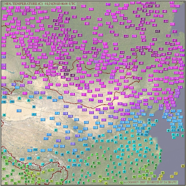
At the weather forecast center in Ulaanbaatar I found out that the coldest temperature in this winter in entire Mongolia was measured in 24 January at Tsetsen Uul and it’s -53.2 degrees Celsius. This value is almost the same with my logger’s absolute minimum (-53.0 degrees) which was registered in the same day. Outside Erdenekhairkhan, Tsetsen Uul is the closest station to my research camp (around 55 km’s in straight line) and it’s also situated at a similar elevation. The snow cover’s thickness during this period was 16 cm there, which is also very similar with the snow conditions at the frost hollow’s bottom, what I approximated to be around 15 cm. Because of it’s slightly convex topography, Erdenekhairkhan reached only -35 degrees on this coldest day. The next lowest temperature is -51.8 degrees, recorded at Bayantes (Gandan Huryee station) three days later in 27 January (the minimum on 24 was -51.7 degrees). Tes from the famous Uvs lake’s basin and Tosontsengel from Zavkhan aimag reached -50 degrees, Otgon and Zuungobi around -48 degrees.


The weather forecast center in Ulaanbaatar. My guide helped me to meet the local meteorologists at my arrival and also after I finished the research. The personnel was helpful and interested in my study. 

Actually (according to the statistics found on Ogimet) there is only a single station in the entire world, which recorded a lower minimum temperature in 24 January than Tsetsen Uul and my frost hollow. It’s Toko from southern Yakutia with -53.4 degrees Celsius, a very subtle difference. The next closest is Summit station from the middle of Greenland’s ice sheet with -52.2 degrees. Verkhoyansk recorded -43.4 degrees on this day, Ojmjakon even less as the weather was snowy.


The minimum temperatures of 24 January in Eastern Asia (source: Ogimet). The two -53’s are Tsetsen Uul (Mongolia) and Toko (Yakutia/ Russia), the -52 is Gandan Huryee (Mongolia)


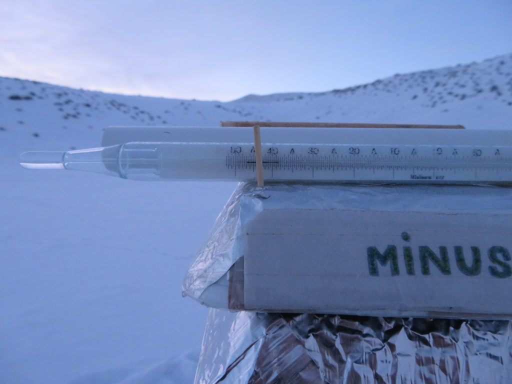
Comparing the measurements of the 3 instruments

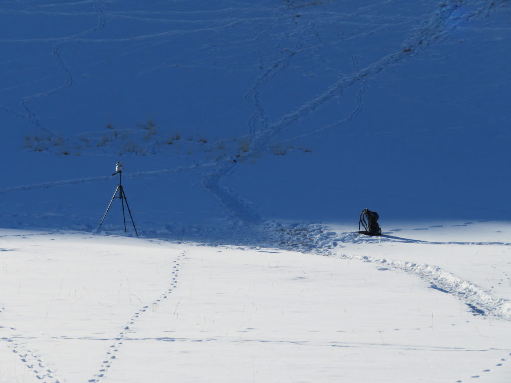
During my visits to the frost hollow’s bottom I made some instant temperature measurements with the precision electronic device and also checked the minimum thermometer’s index and alcohol column (keeping both around the same height with the logger). I made some pictures of these measurements which I can compare with the logger’s recordings at the closest time marks.

In 18 January in the morning the minimum thermometer’s index was stopped at -38.5 degrees Celsius. Meanwhile the logger have registered only -36.0 degrees. This will remain the biggest difference between the two devices until the end of the research. As in the first night the loggers mounting permitted more contact between the device and the shield’s interior, I think the difference was intensified by too much isolation on the logger’s side. Therefore I changed the loggers positioning inside the mounting the next day to have the least possible contact between the device and the surrounding material. I also raised a little the uppermost part of the shield to enhance the ventilation.
I consider this change have altered a little the daily temperature recordings as the logger’s uppermost part received some sunshine during certain parts of the day. I made this sacrifice because the night minimum’s accuracy was my first priority.

In 22 January in the morning I found the minimum thermometer’s index stopped at -47.3 degrees Celsius, while the logger registered a night minimum of -46.7 degrees. The difference is much smaller than the previous time (0.6 degrees vs 2.5 degrees), so I consider the changing in the mounting an useful intervention. In this morning I have a picture with my electronic device showing -46.4 degrees at 8:58 AM. The two measurements of the logger taken the closest to this minute are -45.5 and -45.6 degrees. That’s around one degree difference.


The lowest value recorded by the logger in the morning of 24 January

In 25 January in the morning I found the minimum thermometer’s index stopped at -52.2 degrees Celsius, while the logger registered a minimum of -50.3 degrees. This is again a bigger difference (1.9 degrees) between the two and it can’t be caused by the mounting. From this morning I have pictures of the electronic device showing -50.7  and -50.5 degrees at 9:00 AM, respectively 9:07 AM. Meanwhile the logger recorded -49.5 and -49.8 degrees Celsius. That’s again the same one degree difference. During this time the minimum thermometer’s alcohol column was showing between -51.5 and -52.0 degrees. This is another one degree difference in the opposite direction of the precision device’s measurement. As this more than one degree difference between the two devices remained constant after the last research day (the alcohol thermometer shows 1-1.5 degrees lower values even at room temperature), I consider the minimum thermometer lost his previous accuracy, when the two instruments had the difference around or less than half degree.

As the digital precision device is the most accurate between the 3 instruments (+-0.1 degrees), I will try to approximate the real absolute minimum of the 8 day research period. Since the electronic device was always measuring around one degree lower temperatures than the logger, in my opinion this value is around -54 degrees Celsius, exceeding even the coldest temperature registered at a mongolian weather station (Tsetsen Uul) in this winter. This corrected value also exceeds the coldest temperature recorded in the entire world in 24 January 2018 (Toko, Russia: -53.4 degrees Celsius) and approaches the absolute lowest temperature measured in Mongolia by around one and a half degrees (the -55.6 degrees Celsius recorded at Zuungobi).

Definitely a successfull journey and a productive research.


Nariyn Golyn Els: the frozen desert (2/3)

Journey photo album

The Government Palace on the Chinggis Square, Ulaanbaatar


The statue of Genghis Khan, the founder of the Mongol Empire


Crowded traffic and heavy smog in the city center


The statue of a famous local person in front of a hotel


My hotel room in UB with the radiation shield mounted on the tripod


Me and my guide at Chinggis Khaan International Airport


Soon the plane will depart to Zavkhan aimag


Arriving at Donoi airport, Uliastai


Meeting the driver. As he doesn’t speak any foreign language, my modest mongolian knowledge will be the main communication method in Zavkhan aimag. Fortunately my contact person from the tourism company purchased a local SIM card for me to can call him if necessary. 


On the way to Erdenekhairkhan. Not a single settlement on the 80 km dirt road. And only a few cars. 


Big sheep herd near the road


Approaching the driver’s village


Our street


The driver fires up the oven in his yurt


Meeting the mayor at his home


We start the trip to the desert, but soon the car is blocked in the snow


Reaching the sandy area


Following the single track in the waste


Visiting a nomad family (yes, they have satellite dish)


From here I will continue by foot


Desert people, real survivors


The view from the top of a higher dune towards the research place


Reaching the rim of the chosen depression


I put up my tent on the lowest portion of the rim


The first sight to the bottom of the hollow (around 4 PM). The sides are much steeper than I was expecting, above 30 degrees in many parts. Became pretty windy here


Installing the tripod with the data logger inside the radiation shield


The minimum thermometer on the top of the shield (now around -19 degrees Celsius)


The sun still shines outside the bowl


In the late evening I checked the instruments and found the minimum thermometer’s index blocked. Problem solved, around -34 degrees after 11 PM


The result of the first night: -38.5 degrees Celsius


Around 10 AM the hollow is still in full shade. It’s time to leave the camp


A group of horses in the barren landscape


Magnificent view from the top of a higher dune


The car is coming after me


Next day I go to a hike to the Mukhart river’s source, one of the main eyemarks of the region


Approaching the huge dam-like sand structure. Strong windchill here, otherwise not below -25 Celsius


The Mukhart oasis from the top of the huge horseshoe  (almost 200 meters high). It’s like an enclosed river delta


A lil’ rest and snack is welkomed as the wind weakens


At the bottom of the crescent shaped sand mountain. The water came out from the sands from all sides. Pleasantly warm in the full sunshine of the early afternoon


The water looks dirty brown because of the sandy bed. Nice ripply surface otherwise                                                                                                                                                                                                                                                                                                                                                                                                                                                      
Deers on the top of a smaller hill. I was surprized to see these animals in the desert                                                                                                                                                                                                                                                                                                                                                                                                                                                                   
Many yaks are grazing on the sunny side. The river attracks the animals as it is one of the few sources of water here, outside the snow                                                                                                                                                                                                                                                                                                                                                                      
Back to the car. Today the sky was completely clear
On the way back to the village                                                                                                                                                                                                                                                                                                                                                                                                                                                                                                                                                            
The weather station of Erdenekhairkhan at sunset


The next day I visit another hollow, very similar in shape and size with the chosen one, but this one is closer to the track/ village and has lesser snow. Also it’s situated at lower elevation (around 1700 meters at the bottom)


The source of the Nariyn river is also close to the track. Its geomorphology is similar to Mukhart’s, but at a smaller scale (around quarter size)


Powdery frost covers the prickles of the desert shrub


Back to the ger (local name for yurt). The driver is preparing fish for dinner


Oh, yeah! The forecast for Tsetsen Uul looks excellent. -50 degrees soon!


The next day we are going again to the dunefield to approach my research area. I will spend another night in my tent. I guess it will be much colder this time                                                                                                                                                                                                                                                                                                                                             
Isolated yurt near the desert track. Two black guardian dogs followed me awhile


An unexpected encounter with a nomad herdsman not far from my camp. He visited my tent and was very curious about everything. Including vodka


Hat change and we are the best friends. Just kidding. I want back my favorite teal cap


Okey, the mini weather station looks untouched. Let’s check the logger’s minimum


A decent value. I’m pretty sure the following night will be even more colder. But now, in the unperturbed afternoon sunshine the weather is pleasantly warm


Yep, that’s my lordship. Something like the biblical Canaan. However this one doesn’t produces fruits but cold…


This quadruped appeared from nowhere. And disappeared the same way. He must be from the closest yurt, around 2 km’s from my camp. Maybe my friend’s dog (?)


While I go round the depression the shade reached the bottom


Already -40 and it’s still sunshine outside the bowl 


A long, cold night is waiting for me. Even if I will not sleep too much, the sustained rest will help the organism to regenerate


Still dark. I slept little and often as usual in similar conditions. Outside the sky was constantly full of stars. Ironically, my nose is not frostbitten but burned, as now I am UV sensitive because of a longer antibiotic treatment. Nevertheless, the “cryotherapy” probably doesn’t promoted the healing…


Not particularly warm…


…but I have a nice menu


Outside is a little chillier. But I am on the rim. What about the hollow’s bottom?


At dawn I descended to the depression to check the instruments


Oh, yeah! That’s certainly not for barefoot walking


-47.3 on the alcohol thermometer. That’s a good minus, Minusz!


Okey, the logger recorded a similar minimum. January 22 is the coldest day until now


I’m satisfied with the results. It’s time to leave the camp again. But the logger still have 3 days to register


Big herd of sheeps not far from my research place


Who said horses are sensitive? These animals are built for the cold


Crossing a higher rocky top on the way back. The weather is pleasant again. Huge difference between the morning and the early afternoon hours 


A portion of the Khangai Mountains behind the dunes 


Yeah, it’s really warm now. And I have plenty of time. And space


The driver and his friend are coming after me. The baby doesn’t really like the expedition…


In the next morning: the driver’s daughter is ready for school 


Horse statue in Erdenekhairkhan’s centre. The animal is venerated in the country. As they say: “A mongol without a horse is like a bird without the wings”                                                                                                                                                                                                                                                                                                                                
A very common bird in the settlement and its surroundings


The village seen from a small hilltop with Altan Khairkhan (Golden Holy Mountain) in the background


An old resident peacefully smokes on the street


The buddhist monastery of the settlement


My “colleague”, the weatherwoman checks the air temperature in the instrument shelter. The village has a somewhat milder climate because it’s not situated in a valley or basin bottom. When at Tsetsen Uul and Tosontsengel the temperature plummets below -40 degrees, at Erdenekhairkhan is only around -20, -25. But now is colder. Tsetsen Uul recorded -51.6 degrees Celsius this night, the coldest temperature in Mongolia this winter 


The “ovoo”, a mongolian sacred cairn is very common on higher elevations (mountain tops and passes) and are used by the locals as altars or shrines 


The roof of the yurt is a significant part of the construction as it represents the sky, joining the earthly and the spiritual realms


In the coldest morning we start the last trip to the desert


We try to approach the camp more this time as tomorrow we need to go back to Uliastai. However this portion is too difficult, the driver will not risk. Final distance to the research area, as the crow flies: 6 km


Like the horses, the camels are also extremely well prepared to survive in the coldest conditions. These desert giants are very calm and peaceful, moving away only when you are really close to them. And they are constantly watching you, slowly turning their heads while walking. A lil’ weird


Yeah, today it’s colder. But the full sunshine and complete calm of the early afternoon hours tricks the senses


The tent is still intact. Let’s check the tripod


Well, well. The top part looks a lil’ moved. Maybe my nomad friend was also curious? Fortunately the logger is still there, recording 


Yesss! This is exceptional: -53 degrees Celsius! Only 2.6 degrees less than the absolute record of the country measured in Zuungobi in the 70’s 


The last sunrays of the day saying goodbye to the shield. It’s only 4 PM


I climb to the top of the rim. Meanwhile the shade incorporated the bottom of the hollow. The sky is completely clear, the air moveless. Perfect conditions


-46 degrees before 6 PM. This part of the day is the most fascinating. After the sun disappears, the temperature plummets extremely fast


Outside the bowl the sun is still shining 


From the rim, near my tent, I can watch the sunset


Still not alone


Bright orange on the sun’s side 


Pastel magenta on the opposite part


Near surface temperature at my camp in the last reseach day (at dawn)


The night was completely clear and calm. At the bottom must be extremely cold 


That’s right!  My precision electronic device have never seen such a low value                                                                                                                                                                                                                                                                                                                                                                                                                                                           
Still below -50 at head level too. As I was warmed up well from the strategic morning jogging beside my tent, I wasn’t suffering from the extreme cold of the depression’s bottom. Actually, I consider a -30 with moderate wind more unpleasant and dangerous for the exposed skin than a windless -50


The alcohol thermometer almost “died” . The index is stopped between the last two dashes of the scale: -52.2 degrees Celsius


As the logger shows only the absolute minimum for the entire 7 days + 8 nights period, I can’t check the value for today. The previous -53.0 remains the lowest temperature of the research.  The electronic precision device was constantly indicating between -50 and -51 degrees in this morning


While I packed my camping equipment the sun reached the bottom of the cauldron. After 11 AM I say goodbye to my frost hollow 


You again…


The driver is looking after me from the top of a dune


Last time on the sandy track. That short, steep part was difficult


On the way to Uliastai


Otgontenger (on the left), the highest peak of the Khangai Mountains (4008 m). Because of a recent tragic accident the ascent of the mountain is forbidden. Maybe another time…


Uliastai at sunset from a small hilltop. I will spend the night at a hotel in the town. Hopefully we can found a quiet one


An angry deity tries to scare me. These mitological entities are originating from the tibetan folclore 


Bye Zavkhan aimag! It was my pleasure 


Don’t worry. This guy is very contented. He just needs some sleep. And face cream


Otgontenger from the plane


Next day in the capital I visit the Gandantegchinlen monastery 


The 26.5 meter high standing Buddha is known as the tallest indoor statue in the world 


You can appreciate the sizes more from this picture


The Blue Sky Tower, one of Ulaanbaatar’s most emblematic buildings


Last dinner in Mongolia. Tomorrow I will fly back to Europe. I don’t know if the winter has finally arrived there. What I know is that mine is over.


To be continued…


Nariyn Golyn Els: the frozen desert (1/3)

Intro:  The coldest capital city

Mongolia is well known as one of the coldest countries in the world and his capital city, Ulaanbaatar is undoubtedly the coldest one. With a January average below -20 degrees Celsius and occasionaly reaching below -40, this place is not for the weaklings. Beside the severe climate the city is enshrouded in heavy smog, making the breathing even more difficult. The pollution is caused by the phenomenon known as “thermal inversion”, when the dense cold air of the wintertime is sinking to the bottom of the valleys and basins keeping the smoke and other dry particles in the lowest atmospheric layers. The smog is the strongest in the late night and early morning hours when the cooling is the most intensive. This can cause many problems including road accidents and flight delays. Because of these complications there are plans to move soon the capital’s airport to a new place that is more than 50 km’s from the city. The actual “Chinggis Khaan” (named after the founder of the Mongolian Empire) airport is situated about 15 km’s from the center and because of its location in a flatter and more open area is even colder than Ulaanbaatar itself. The temperature difference between the two on an average winter morning is around 5-6 degrees Celsius. In the day of my arrival it was a “mild” -25. But we aren’t there yet.


Ice sculptures in the Sukhbaatar square, Ulaanbaatar


Choosing the target

I have a big passion for deserts. But also for the cold. How about the coldest desert? I’ll try to found it.
With an annual average below -50 degrees Celsius and reaching below -80 degrees in the toughest winter days, the interior of Antarctica is unequivocally the coldest place on Earth. It can be considered a desert if your classification is based only on the precipitation ammount which is extremely low there. But if your criterions are more complex and it includes also the landscape component, then you must switch your search to the Northern Hemisphere. Yakutia in Eastern Siberia is the coldest region in the boreal half (also has the coldest permanently inhabited places), but there is only taiga and tundra zone, no deserts. That’s why most sources come up with the Gobi as that one is the biggest and most known example of what a cold desert is. But it’s not the coldest one. The Gobi is situated in the southernmost part of Mongolia (also continues more to the south in neighboring China) but there are some smaller deserts in the north-western part of the country where the winter averages are much lower than in the famous stony desert.

The mean January temperatures in the mongolian Gobi are mainly between -12 and -20 degrees Celsius (Dalanzadgad -15, Sainshand -18 degrees) and in the chinese part mostly between -8 and -15 degrees (Dunhuang -8, Ejin Qi -11 degrees). Pretty low for sure, but not even close to the bone chilling -33 degrees of Ulaangom in Uvs aimag* (local administrative division, similar to province or county). The town is situated in the Uvs Lake’s basin, known as one of the coldest places in Central Asia, not far from the lesser-known Boorog Deliyn Els sandy desert. In this wasteland is a village named “Zuungobi”, which is the place where the lowest temperature in entire Mongolia was measured: -55.6 degrees Celsius. Yeah, that’s cold. And it’s a desert.


From October to April the land of Genghis Khan is affected by the Siberian Anticyclone, a huge collection of cold and dry air masses that is responsible for both the highest atmospheric pressures and the lowest temperatures in the Northern Hemisphere. Actually the center of the Siberian High in midwinter is in north-western Mongolia, consequently here was recorded the world’s highest barometric pressure. Most Internet sources are claiming that Tosontsengel of Zavkhan aimag holds the title with 1085.7 mb (millibars), but there is a place in the western part of the same aimag which (according to the statistics found on Ogimet) have reached even much higher values, like 1098.7 mb in the morning of 9 March 2016. This occured during an unusually strong cold snap when the small village experienced also the lowest temperature in the country for this month, a staggering -54 degrees Celsius. Tsetsen Uul, the peculiar settlement is located in a high altitude basin in the western part of the Khangai Mountains, not far from the limit of the sandy area, which extends here from the Great Lakes Basin, along the Hungui river and its (mainly former) tributaries. In some parts the sand dunes are reaching 2200-2400 metres in elevation, therefore it can be considered the highest desert in Mongolia. Because this region receives a little more rainfall and has cooler summer climate than the western, lower elevations, in some parts you can see pine trees between the sands. This high altitude sandy area raised my attention and I was starting to speculate if it can be the coldest place in the country, respectively the coldest desert in the world.

Because of the strong thermal inversion caused by the anticyclone, as a general rule, in the mongolian winters the lowest places are the coldest, therefore the Uvs Lake’s basin, which is one of the lowest places in the country (below 800 metres at the bottom), is also one of the coldest places. But the reality is a little more complex as Tosontsengel, Tsetsen Uul and Otgon settlements are all situated at much higher elevations (1700-2150 meters) and despite of this they can cool down to similar or often to even lower values than the formerly mentioned region. The explanation is that all three are situated in valley bottoms, which are collecting the sinking cold air from the nearby mountains. Actually the relative position what matters here, not the altitude itself. What’s more, if sufficiently flat and/ or enclosed, the highest basins can be the coldest ones, as in thinner air the nocturnal heat loss is more powerful. The Uvs Lake’s area is so cold because it’s a deep endorheic hollow, from where the collected cold air can’t escape in any direction. If the same topography could exist at higher elevations it could produce even lower temperatures.


The location of the selected research place (red dot) on the map of Mongolia
 Important to mention is that the snow cover also plays a major role in the cooling potential of any given place as the fresh snow blanket isolates the ground and radiates most of the sunrays back into space. However, above 20 cm thickness there is no considerable enhancement regarding this effect. In Mongolia the winter snow coverage is highly variable. Some places like the Uvs Nuur Basin is always blanketed by snow but others only in certain years. The high altitude sandy area usually has snow cover but its thickness is changing from year to year. This season the coverage in the country is well above the average. It means the Siberian High is strong and severe cold snaps are likely to take place. The mongols have a term for the tough winter conditions, they called it “dzud”. For them (especially for the herders) it has an unambiguously bad meaning as it’s related to livestock losses. If the snow is deeper the animals are struggling to found enough food and the starvation in the freezing conditions will decimate them. It means my luck is their bad luck? Sort of…


Satellite image of the high altitude desert of Zavkhan aimag (the small red contour is my chosen hollow) with the approximate desert track (red curve)

In sandy areas, between the dunes are many enclosed, concave relief forms of different sizes, ranging from 1-2 to more than 50 meters deep. With the help of GoogleEarth I identified some huge hollows on the surface of the high elevation desert mentioned before. Subsequently I obtained a digital elevation model (DEM) of the area which also confirmed that some of these negative shapes are around 50-60 meters deep. The endorheic depth is the altitude difference between the bottom and the “outflow point” (the lowest elevation on the rim). The topographical aspect is exactly the same as in the case of the karstic depressions (dolines and uvalas) which are known to produce extremely low temperatures during clear and calm winter nights, therefore often referred to as “frost hollows”.


Digital elevation model of the Nariyn Golyn Els desert (the arrow indicates the location of the small basin)

Between the deeper concavities noticed on the desertic plateau I picked out one, whose parameters (the combination of elevation and depth) appeared to be the most convenient for my research. The hollow has an endorheic depth of around 50 meters and it’s bottom is situated about 1960 meters above sea level. It has a roughly circular shape with a diameter around 1 km. According to my calculations the average slope of the depression is around 11 degrees. There is a term named “sky view factor” which consider the average slope as the major parameter responsible for the cooling potential of a given topographical place. Concave shapes are important for cooling because they are collecting the sinking cold air and also represents protection from the mixing effect of the wind, but if the slopes are too steep than the nocturnal heat loss will be significantly lessened by reradiation from the sides. Ideal is somewhere in between, mostly like a plate shape: concave but adequately open. By the way, eleven degrees is quite good.


Closeup of the hollow with the level lines (1, 3, 5, 10, 20, 30, 40, and 50 meters) calculated on GoogleEarth

The small negative shape appears on my detailed soviet miliary topographic map but without exact elevation data or a name for this particular place. The desert which encompasses also my target zone is named “Nariyn Golyn Els” (meaning “the sands of the Nariyn river”). No settlements and no roads are present in the immediate surroundings. The closest village is Erdenekhairkhan, situated to the south-west about 19 km in straight line. There is a dirt road which approaches more my target (about 10 km’s), reaching the southern limit of the dune field. I think that’s sufficiently close to can handle it by foot with a heavy backpack. GoogleEarth shows that the surface is sandy with some sparse vegetation (I guess shrubs), probably something like the Kalahari or the australian deserts, but the color of the dunes is lighter not reddish.


Russian topographic map of the desert plateau north of Erdenekhairkhan (the arrow pointing to the unnamed depression)

My small basin is part of the “Ulaagchiin Khar Nuur Bioreserve”, a protected area of high altitude sands, mountains and pristine lakes. Khar Lake, Mukhart river and Senjit Khad are the main eyemarks of the reserve, but I’m pretty sure that in the wintertime there are no touristic (if any) activities. We’ll see.


Brief summary of the research

I arrived in Mongolia in the morning of 15 January by the Budapest-Ulaanbaatar (through Moscow) international flight. From the mongolian capital I used domestic flight to Zavkhan aimag’s capital, Uliastai. At the airport a private driver was waiting for me, who was contacted by a tourism company from Ulaanbaatar. Previously this company supported me to obtain the visa at the mongolian consulate in Budapest and helped to arrange the transports and accomodations in the country during the entire journey. The private driver is a japanese 4wd car owner and takes me to his home in Erdenekhairkhan (around 110 km’s), which is the closest settlement to my targeted zone. From his village we approached the reseach area with the jeep, following a sandy and quite difficult track through the Nariyn Golin Els desert (around 20 km). We managed to get close to the target around 8 km’s in straight line. From this point I reached the chosen place alone by foot along the dune field, carrying the camping equipment and the meteorological devices in a backpack.


One of the few people who are living in this desert in the wintertime

The area is remote, but still have some human activity in the wintertime. I saw 3 yurts and more herds of sheeps and goats along my hikes. Some horses and camels are grazing unsupervised on the dunes. The few people who are living here are moving on horseback and are doing daily circuits with their herds, the yurts are not moved in the cold season. Despite its isolation and severe climate, the desert’s surface was full with animal trails.


The frost hollow from the north-western rim

I raised my tent some hundreds of meters west from the actual research place, on the lowest part of the selected hollow’s rim, around 2007 meters above sea level. The tripod with the data logger inside the home-built radiation shield was set on the lowest portion of the frost hollow, about 1942 meters above sea level (according to the GPS). It means the depression’s endorheic depth is around 65 meters (16 meters deeper than according to GoogleEarth). The low-point’s exact coordinates are: 48.15.460′ N, 95.52.914′ E. The logger’s elevation above the surface was around 160 cm’s. This device was constantly registering the temperature from the afternoon of 17 January until the morning of 25 January. On the days when I was present in the region (three nights) I have set the minimum alcohol thermometer on the top of the radiation shield to measure the night’s lowest temperature. The precision electronic device was used to take instantaneous measurements of the air (holding the device in hand at head level while moving) and near the surface (leaving the instrument on the snow).


My tent at the “outflow point” of the depression

Outside a smaller exposed side from where the snow was partially missing, the depression was snow covered, with around 15 cm of snow at the bottom. The weather was constantly good, mostly clear or partially covered by cirrus and cirrostratus clouds, seldom with transitory altocumulus appearances. The wind was rare and mild, at the bottom mostly completely missing.
The research period was encompassing eight consecutive nights. From this I spent three nights in my tent, the remaining ones in my drivers yurt in Erdenekhairkhan.


The tripod with the instruments at the bottom of the bowl


The devices used in the field

-One Alpha TD80 data logger from Tempsen with the measuring range between -80, +70 degrees, an accuracy of +-0.5 degrees Celsius and a resolution of 0.1 degrees Celsius.
-One Greisinger GMH 2710-T digital precision thermometer with the measuring range between -199.9, +200 degrees Celsius, an accuracy of +-0.1 degrees Celsius and a resolution of 0.1 degrees Celsius.
-One meteorological alcohol minimum thermometer, USSR, 1988, with the measuring range between -50, +40 degrees Celsius (the first dash corresponds to -52.5 degrees).
-One photo camera tripod serving as the support for the instruments.
-One home-made radiation shield constituted of superimposed bowls made of polystyrene, covered with aluminum foil.


The precision device doing his job


To be continued…