Journey photo album


To be continued…
Challenging the temperature scale in the harshest climates on Earth
To be continued…
First research night (12-13 January)
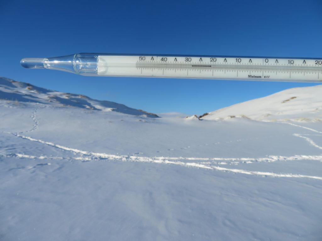
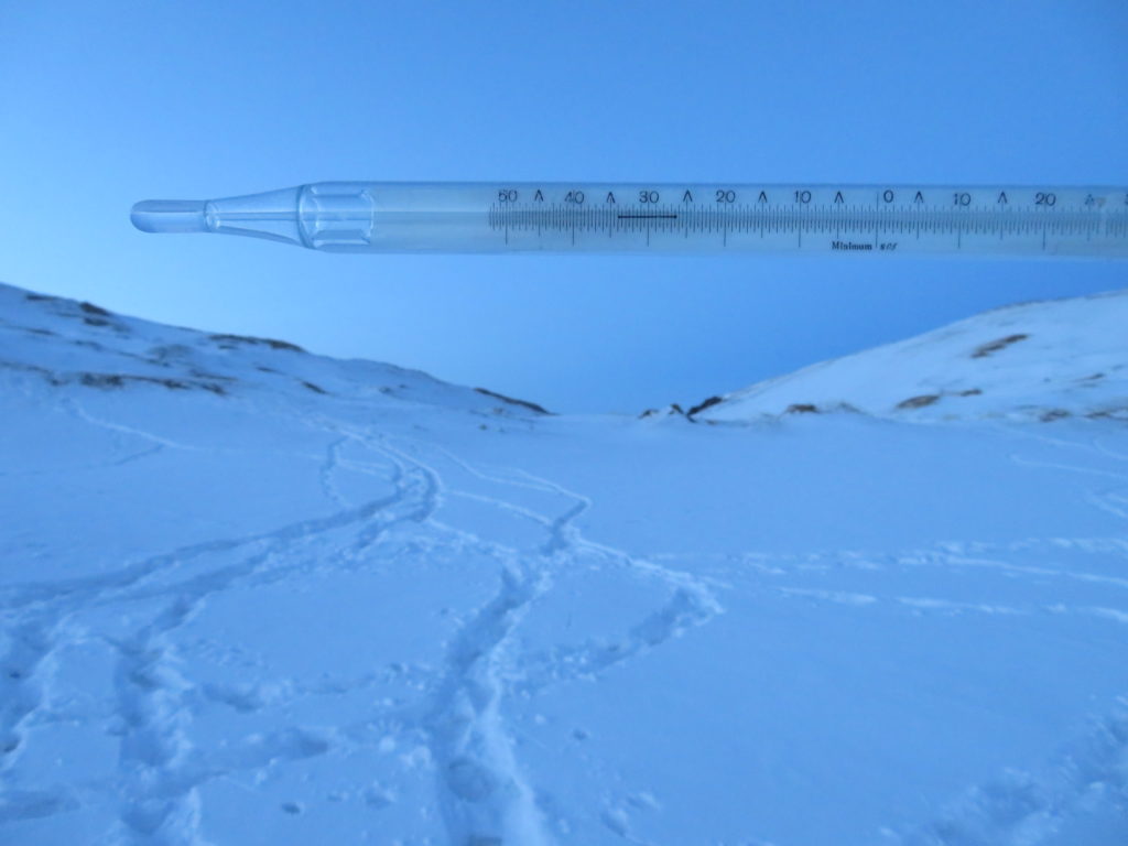
The tripod with the minimum thermometer was set around 5 PM at the bottom of the basin. The sky was clear, no air movement, still sunshine at that time. The alcohol column of the instrument showed -28 degrees Celsius. Shortly after the installation became shadowed and until 17:40 (when I left the hollow) the temperature decreased to -33.5 degrees. Near the snow surface I measured -36 degrees.
The first part of the night was completely clear and calm at my tent. After 3 AM (it was almost full moon) I observed some cirrus, than cirrostratus clouds invading the sky. At dawn I measured -17 degrees at head level and -23 close to the surface near my tent. In the hollow was -35 degrees in the early morning (-37 close to the surface), while the minimum of the night reached -41.9 degrees Celsius. This will remain the lowest temperature captured in the entire research period. In the same night Tsetsen Uul (the most representative weather station of the area) reached -38.4 degrees.

The 13-17 January interval
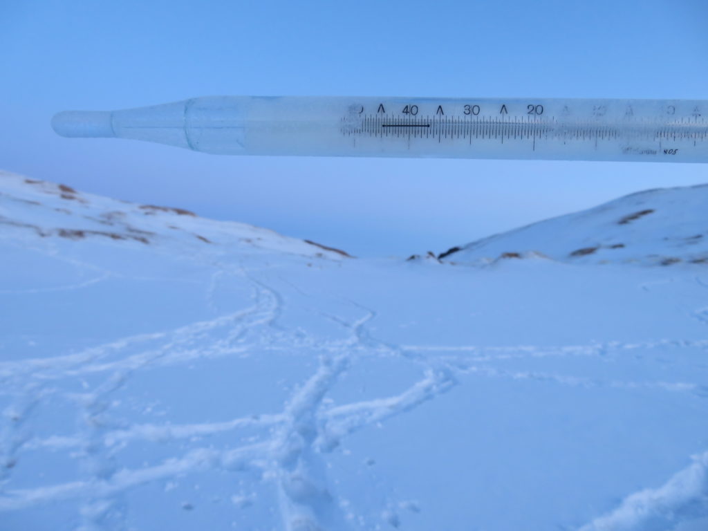
I left the research area in the morning of 13th January. As I had no logger to record the temperature curve, the single certain data what I will have after my return is the minimum value for the entire missing period. I visited the hollow for the second time in the afternoon of 17th January, when I found the index of the instrument stopped at -38.5 degrees Celsius. I can’t be sure which night gave this value, can’t even exclude the same morning when I left the basin. However most likely happened on the night from 14 to 15 January, when Tsetsen Uul reached -37.2 degrees.
Second research night (17-18 January)
The afternoon was changing from full sunshine to partly cloudy (cirrus-cirrostratus with some altocumulus lenticularis) and was warmer than on 12th, with the temperature around -21 degrees. The evening started well with clear sky and still air, but later in the night it became windy. No clouds till the morning, but the intensified wind completely destroyed the inversion of the basin. The temperature raised from the -40.9 minimum value to above -20 degrees before the sunrise. The same pattern can be observed in the statistics of Tsetsen Uul, which recorded -36 somewhere in the early night hours and warmed up to -19 degrees till the morning.
The 18-22 January interval
I left the research area in the morning of 18th and visited the hollow again in the afternoon of 22th January, when I found the thermometer’s index stopped at -39.6 degrees Celsius. This almost certainly happened in the morning of 19th January, when Tsetsen Uul recorded -35.6 degrees.
Third (last) research night (22-23 January)
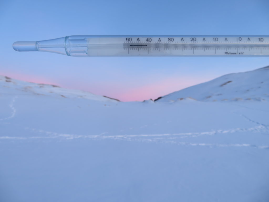
The entire day was generally fine, also much warmer, with the afternoon temperature of -16 degrees. There were only intermittent light air movements, but thinner cirrus and cirrostratus clouds were partially covering the sky constantly. This setting continued also in the night, when the sky was starry, but slightly blurred. No wind till the morning. I’ve measured -17 degrees near my tent at dawn, which was a surprisingly high value, as I saw 2 degrees colder in the early evening hours in the same place (!) In the basin the minimum thermometer’s index was stopped at -36.8 degrees, while the temperature at the moment was also close to this value (around -36 degrees). This was a good night, very likely presented the characteristic temperature curve, but because of the too high starting temperature couldn’t reach too low, despite the 20 degrees of decrease.
But the most impressive happening was when I descended in a hollow between the dunes, just beside my tent. Certainly no more than 10 meters deep and with the drainage area not bigger than a soccer field. To my great surprise at the bottom of this banal concavity the head level temperature was -37 degrees Celsius at 8 AM (already -35 in the earlier part of the night), a full 20 degrees lower than on the nearby ridge and even slightly colder than the minimum for the entire night in the big basin with hundreds of times more drainage area! Meanwhile the near surface temperature was -39 degrees.
Compared with Tsetsen Uul the Burgastyn Els station reached lower minimums in all the 5 described intervals. The smallest difference is 1.1 degrees, the biggest 4.9 degrees, the average 3.0 degrees Celsius. In three of the five cases the difference was bigger than 3 degrees. According to the statistics on Ogimet Tsetsen Uul had only 8 cm of snow cover that time, while the researched basin had around 20 cm. In my opinion this could give an advantage of 1-2 degrees, but not above 3 degrees.
It can be noticed that the three bigger differences coincide with the three coldest measurements in the frost hollow, while the remaining two with less impressive discrepancies are the ones, when the cold was less severe. Tsetsen Uul’s lowest reading was also on 13th January, but was 3.5 degrees milder than in the high desert.

The most radical conclusion results from the comparison between the small hollow near my tent and the much bigger and deeper researched basin. It is true that it was only a single night, but as the two places are very close, the snow cover similar and the general conditions were characteristic, I am strongly inclined to believe that approximately the same thing would happen during any nights with good potential for strong thermal inversions. I also think that most of the same sized and shaped hollows (which are very common in this desert) will cool the same way as the observed one.
This case is especially interesting as the place is situated right on the saddle, not in an already cooled air mass as it would be somewhere inside the bigger basin’s endorheic sector. Most likely all that impressive “thermal plunge” came from the potential of the small scale topography. Beside these this hollow don’t even have a particularly good sky view factor, as a decent percentage of the slopes have the inclination above 20 degrees.

I have three main conclusions related to the above mentioned facts:
-First is that (regarding the drainage area) size doesn’t really matter at all.
-Second is that a 8-10 meters of depth is enough to approach the maximum potential of a frost hollow. The thermal drop will happen in a more abrupt way than in the deeper basins.
-Third is that relatively steep slopes are suitable (maybe even necessary?) for fast and efficient cold air pooling, despite the altered sky view factor.
As a summary this season was a modest one without a single really good night in the researched period, but the last one’s teaching compensated me for the lack of minuses. A return to the area (hopefully with all the necessary devices this time) is likely.

Mongolia again. All in all it’s the country with the best potential for my plans. Home to the Siberian Anticyclone’s center it offers the biggest chances to experience strong winter temperature inversions. The area is huge, the places remote and wild, relatively untouched by the modern world. The natural advantage is enhanced by the appropriate socio-political situation, where visitors can experience real freedom.

Two years before, while researching the sand dunes north of Erdenekhairkhan I had great luck with a powerful cold snap, when at the bottom of a 60 meters deep hollow my logger registered a stunning -53 degrees Celsius, the lowest temperature ever seen by my devices.
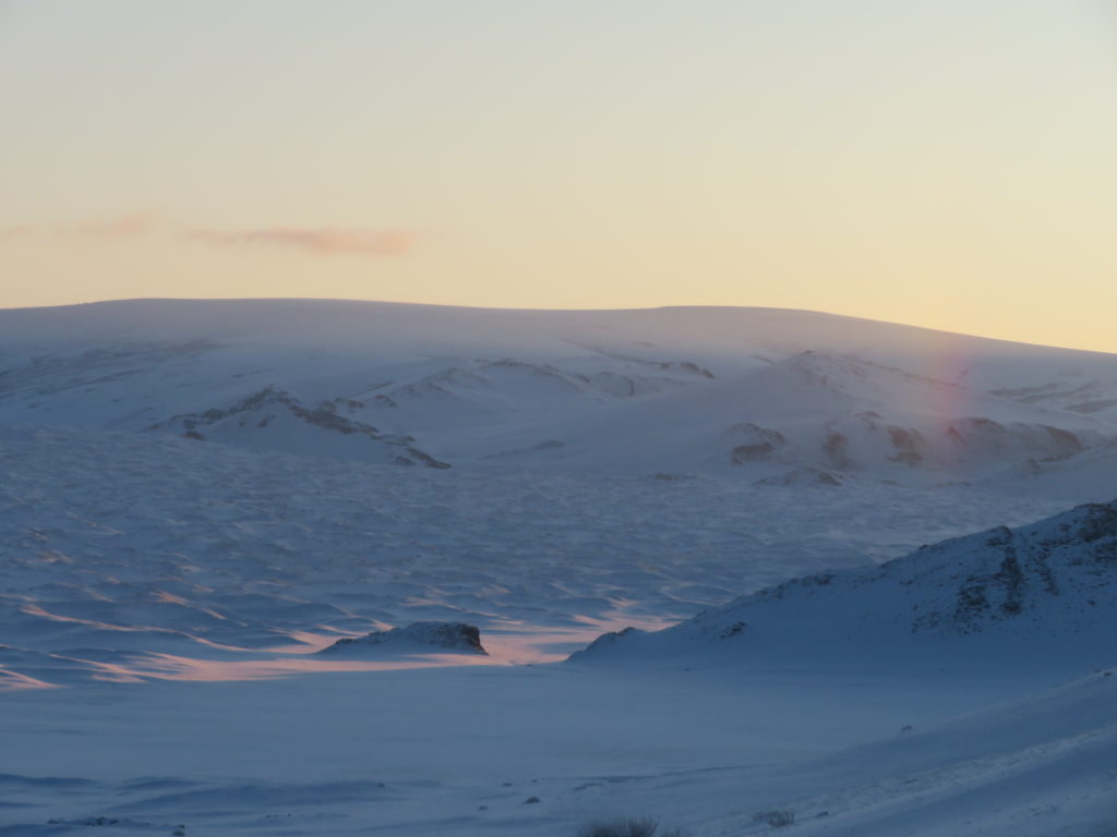
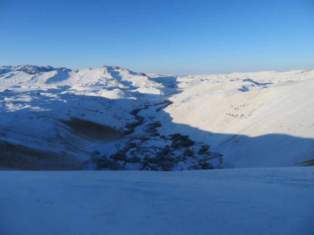
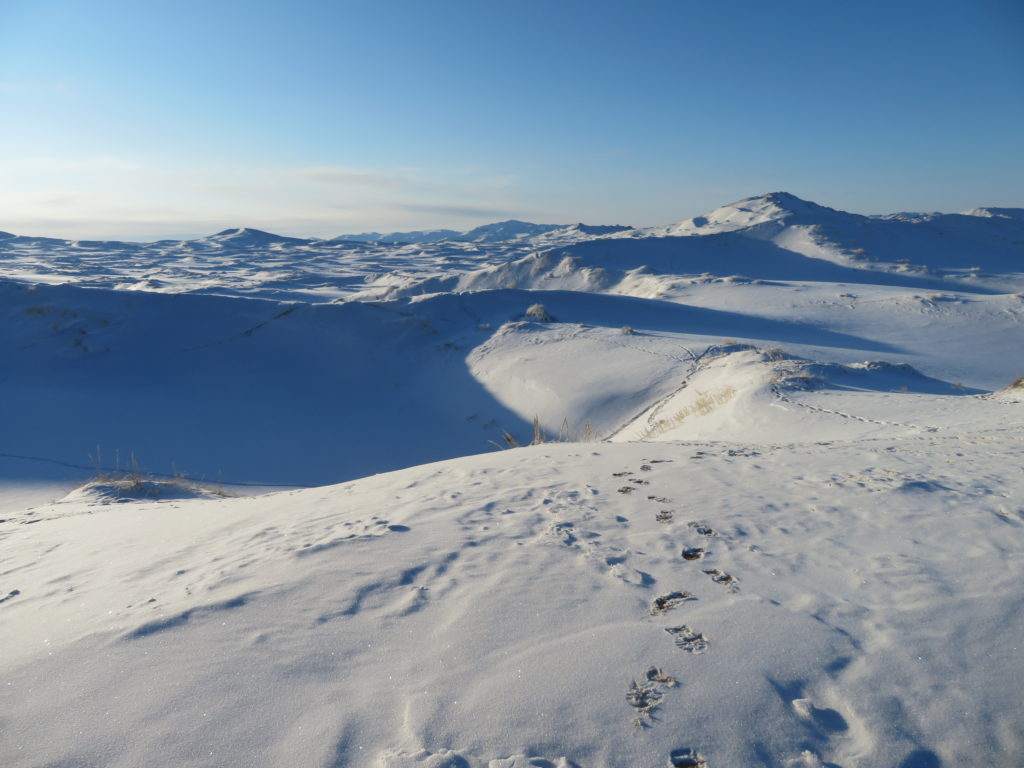
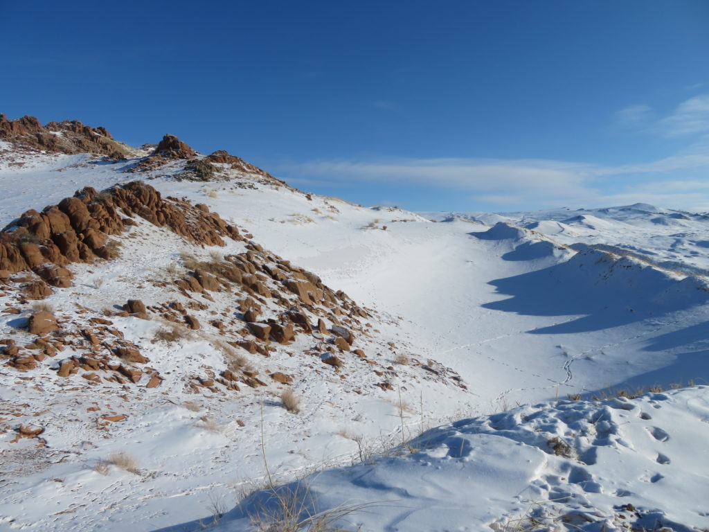
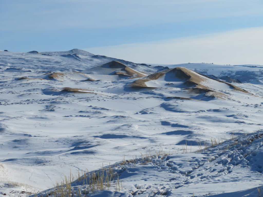
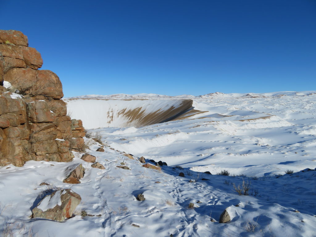
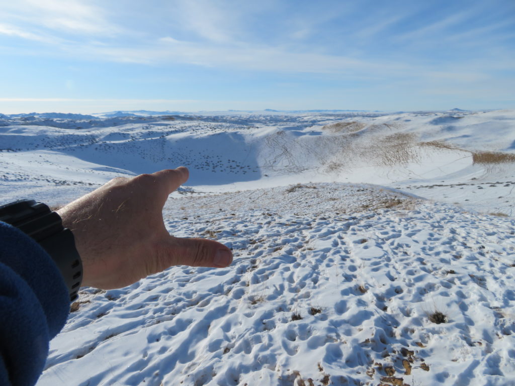
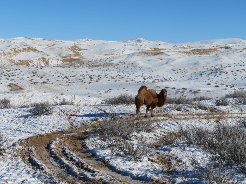
This year’s plan is to set the equipment in another sandy depression a little farther to the north-east, where the dunes are touching the slopes of a mountain ridge. The easternmost, respectively highest part of the desert is called “Burgastyn Els” (meaning “bushy sands”). As the desert itself has no bushes, its name’s origin must be the fact that it’s situated just below the partially bush covered mountain, which is named the same way: “Burgastyn Uul”. The chosen basin is about half the depth of the previous one, but with a bigger drainage area. With its bottom situated around 2200 meters, it’s also the highest between the sand covered hollows with considerable depth (more than 20 meters).
Actually the sand is “climbing” the mountain, as you can see the dunes continuing their eastward way on the other side through the saddles, reaching and invading the remote Ulaagchiin Khar lake. Even the 2600 meter high top has a sandy overlay.

Just a few days before the asian journey the sensor of my logger became damaged and the bad timing made impossible to repair or substitute the tackle. That meant I was constrained to leave at home also the Barani radiation shield and rely mainly on the alcohol based minimum thermometer. There will be no temperature curves, no daily maximums, only the lowest values. Fortunately this is the most important thing, so let’s be positive. I also have the digital precision device for instant measurements, which is my favorite tool while on spot.
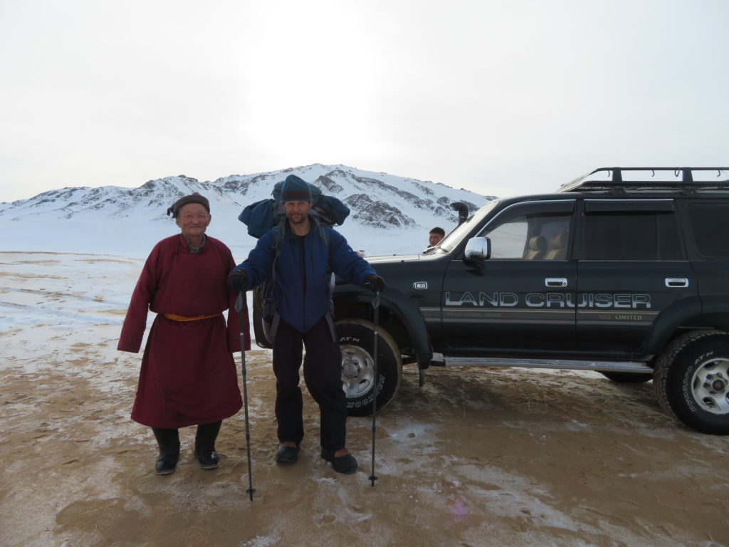
I arrived in Mongolia in the morning of 7th January by the Budapest-Ulaanbaatar (through Istanbul) international flight. From the mongolian capital I used domestic flight to Zavkhan aimag’s capital, Uliastai. At the airport a private driver was waiting for me, who was contacted by a tourism company from Ulaanbaatar. Previously this company supported me to obtain the visa at the mongolian consulate in Budapest and helped to arrange the transports and accomodations in the country during the entire journey.
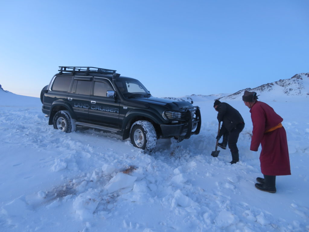
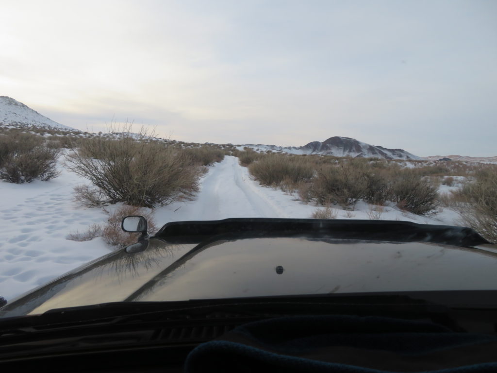
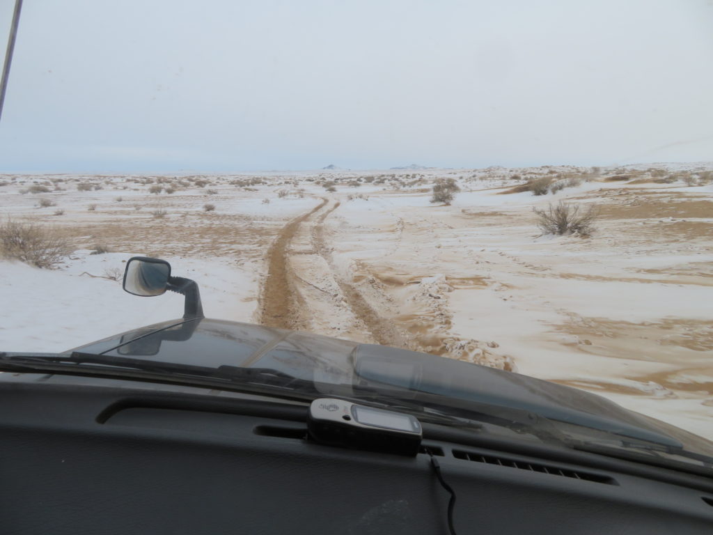
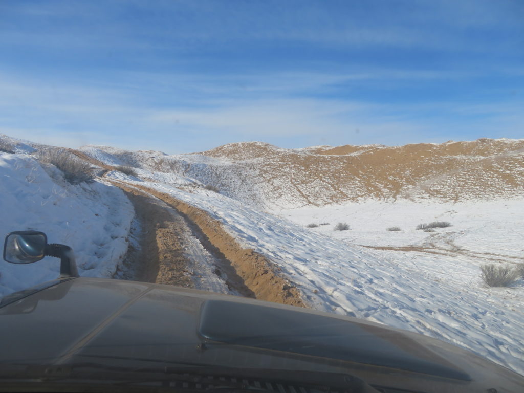
The Toyota Land Cruiser owner came from Gobi Altai province and had taken me to Erdenekhairkhan (around 85 km’s), which is the closest settlement to my targeted zone. From the village we approached the research area with the jeep, following a snow covered track (around 30 km’s) not far from the Mukhart river’s source, a scenic place with interesting geomorphology. We managed to get close to the target around 13 km’s in straight line. From this point I reached the chosen place alone by foot crossing the dune field, carrying the camping equipment and the meteorological devices in a backpack.

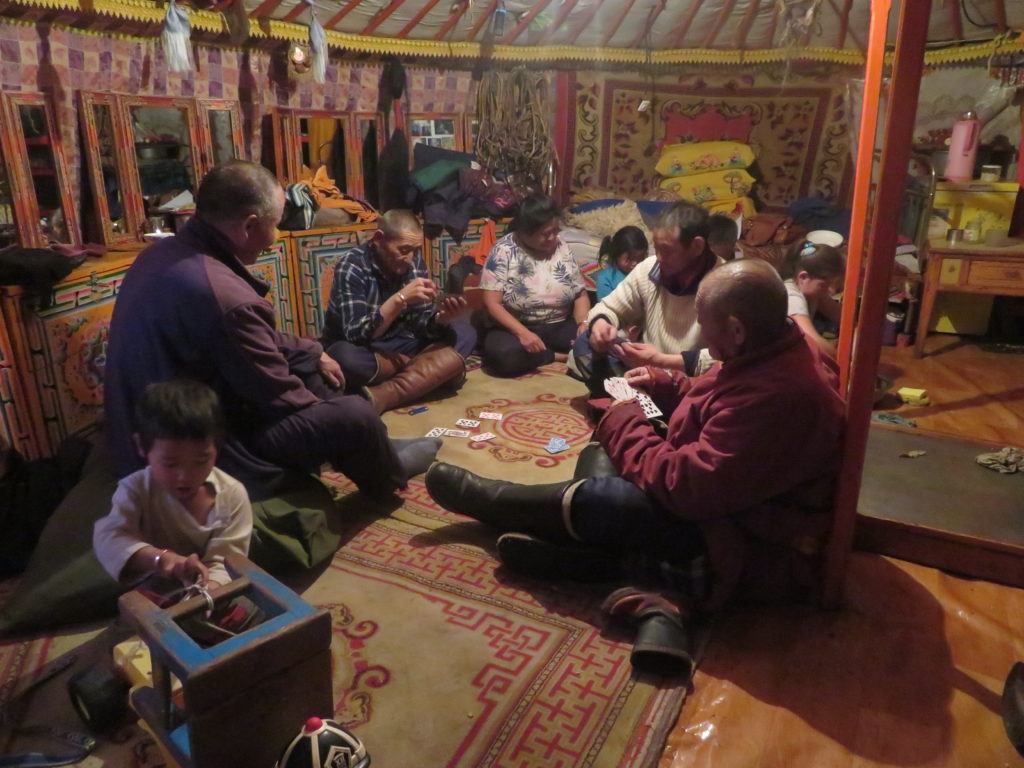
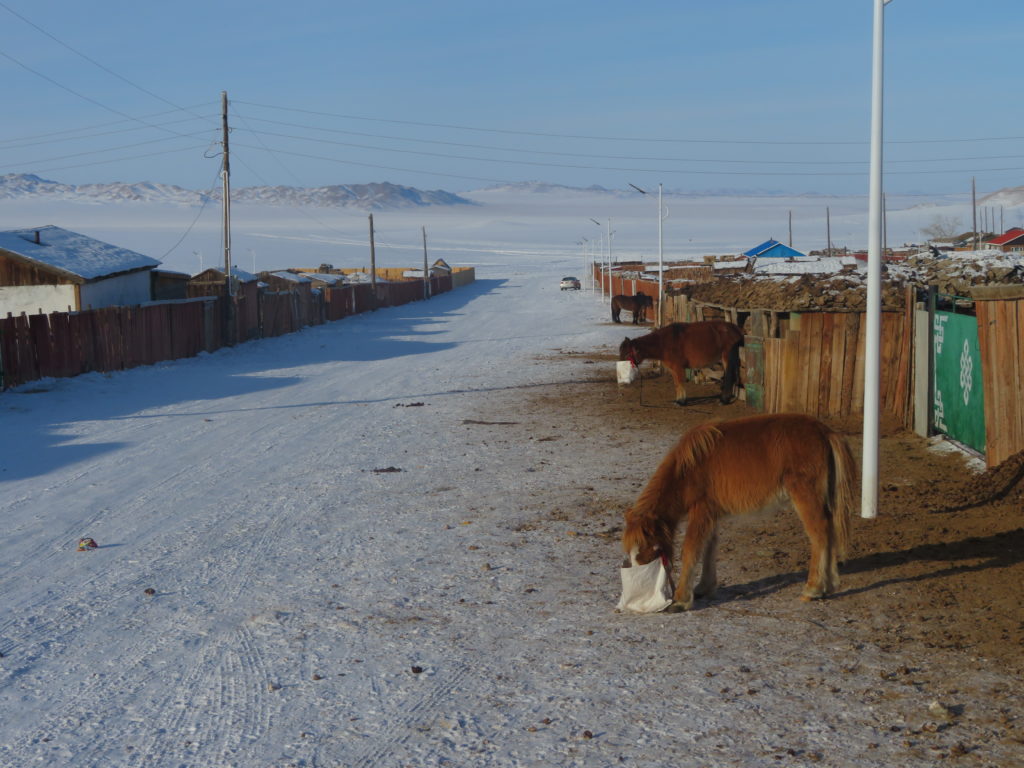
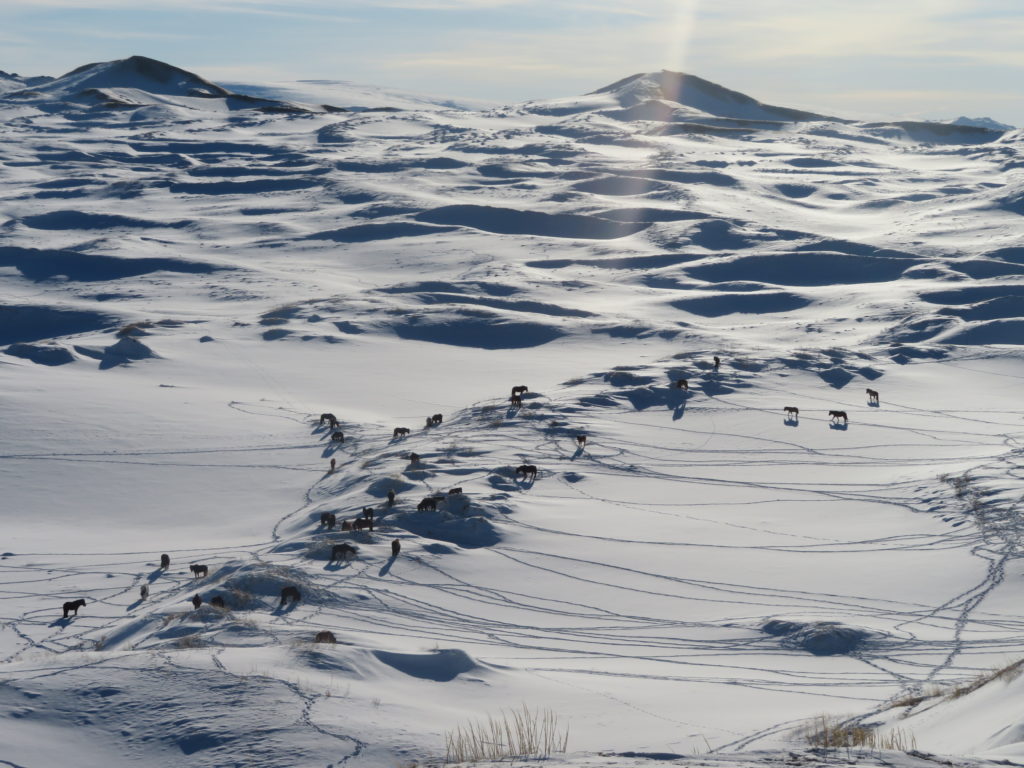
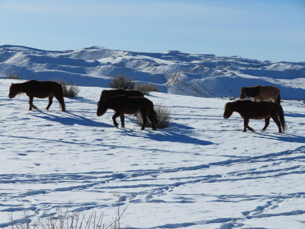
Even so the area is very remote, it still have some human activity in the wintertime. In contrast to the Nariyn Golin Els I didn’t saw any yurts here, only two shepherds on horseback during the entire six days of hiking through the dunes. However many horses and yaks are grazing unsupervised in the desert, many kilometers from the closest populated place.
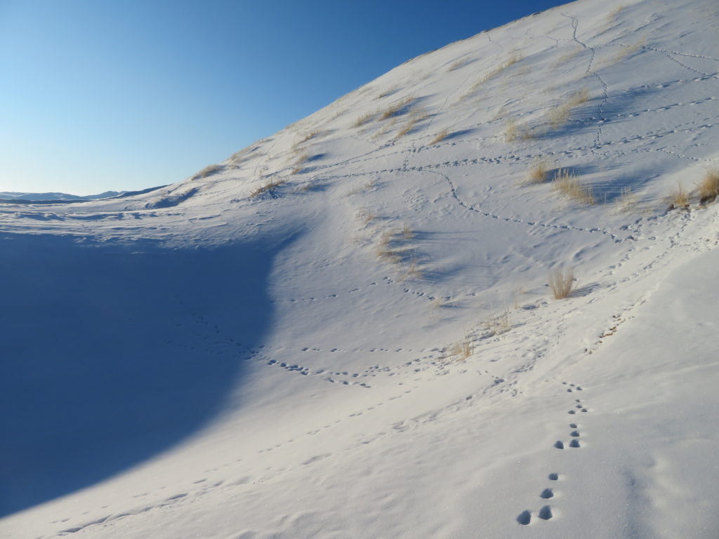
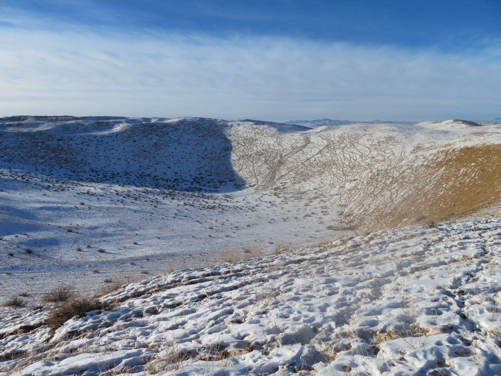
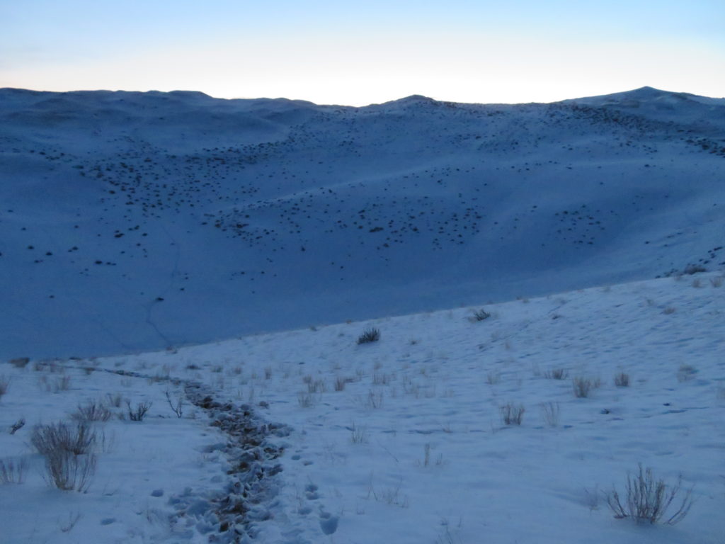
Despite its isolation and severe climate, in most parts the surface was full with animal trails. Actually the single area which was completely lacking the domestic animals presence was the chosen frost hollow. Starting from the southern col there were only a few trails, most likely of deers.

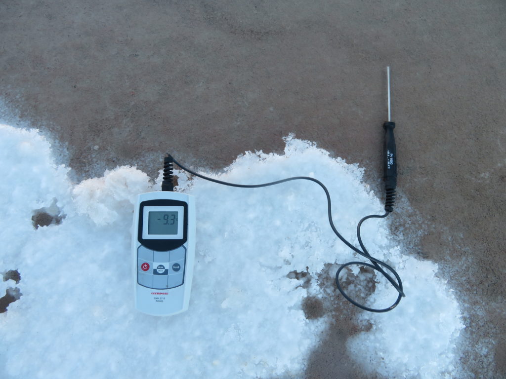
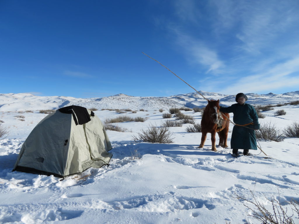
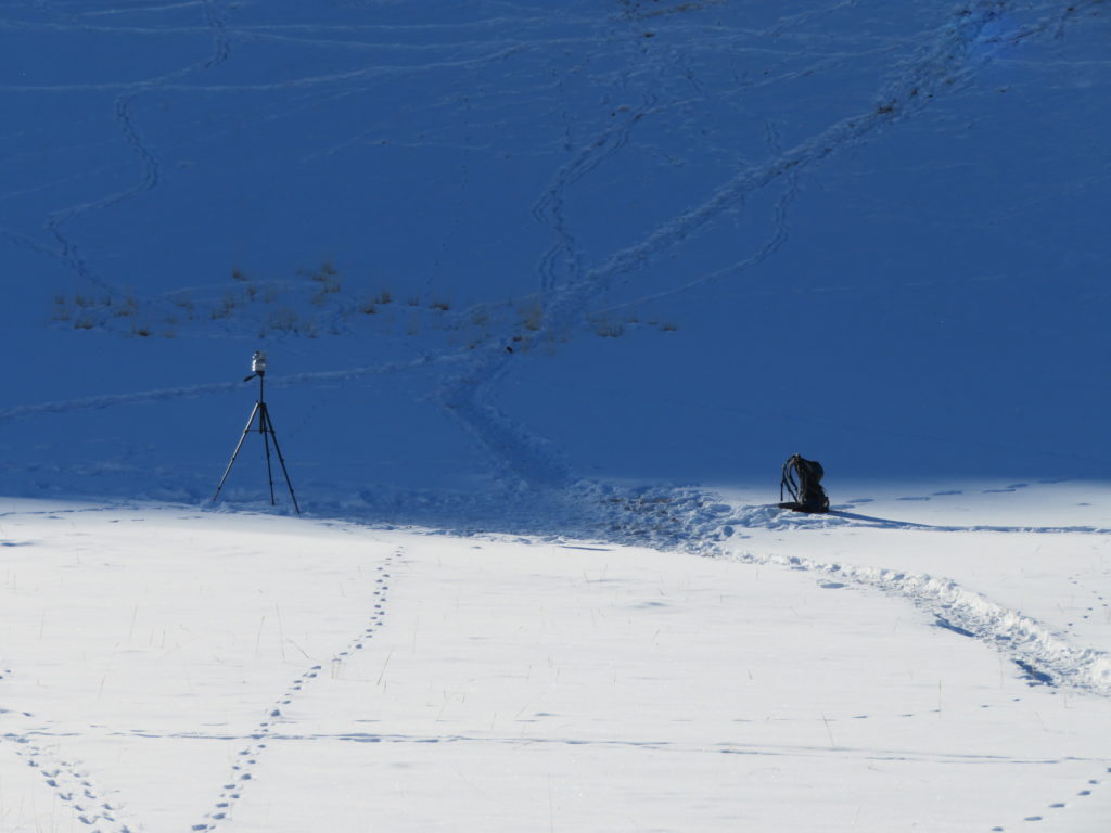
I raised my tent near this southern saddle, around 1 km from the actual research place, at 2250 meters above sea level. The tripod with the attached minimum thermometer was set on the bottom of the frost hollow, at 2194 meters elevation (GPS on spot). During the second trip I’ve visited also the northern col, which represents the outflow point of the depression. According to my measurements the endorheic depth is 28-30 meters (about 5 meters more than GoogleEarth shows).
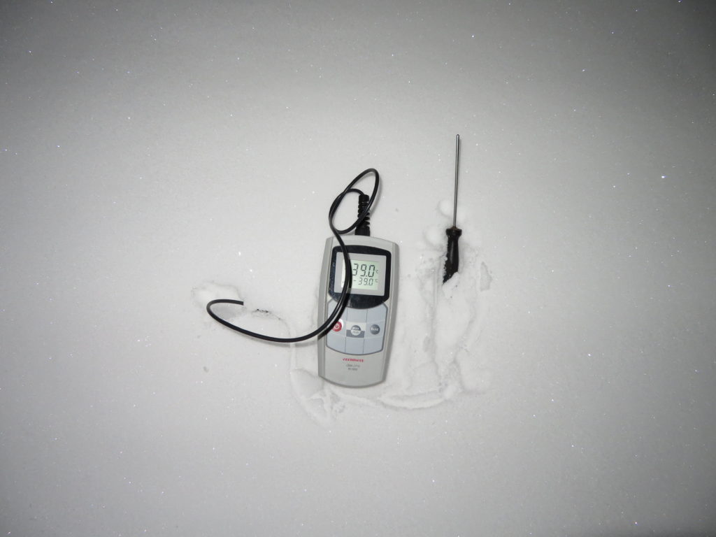
The tripod’s coordinates were: 48.286 N, 96.005 E. The thermometer’s elevation above the surface was around 160 cm. The instrument was measuring the minimum temperature from the afternoon of 12th January until the morning of 23th January. The precision electronic device was used to take instantaneous measurements of the air (holding the device in hand at head level while moving) and near the surface (leaving the instrument on the snow).

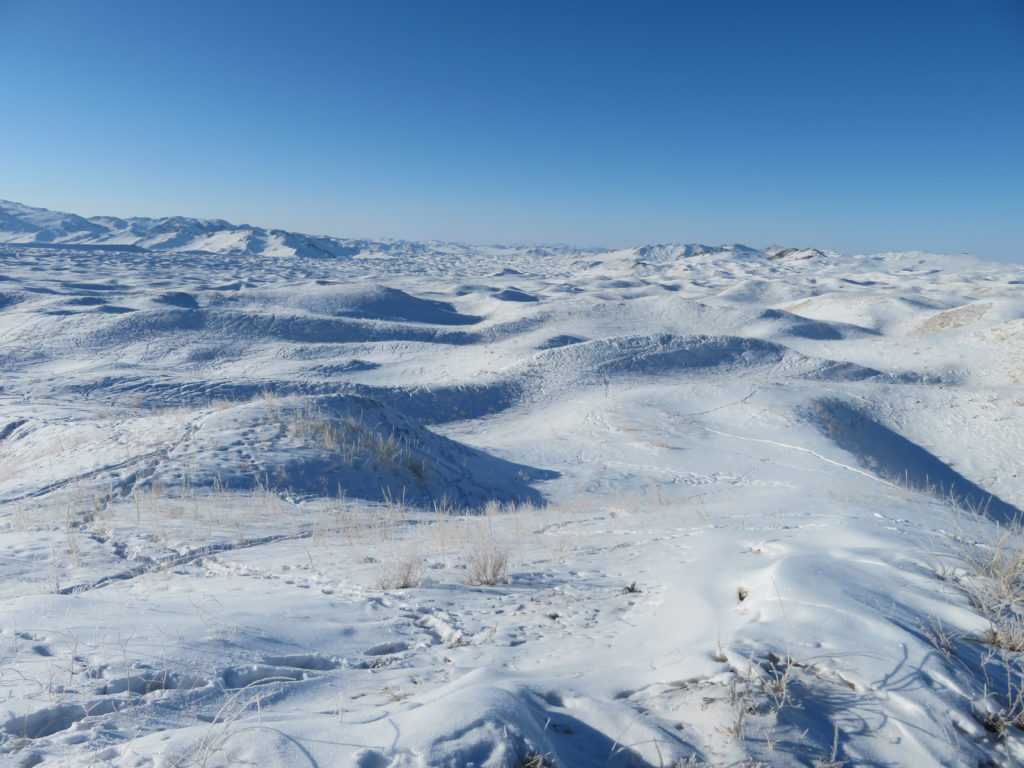
On average the snow in the desert was rather big (for mongolian standards), reaching 20-25 cm on the bottom of the frost hollow. The weather was generally good, mostly clear or partially covered by cirrus and cirrostratus clouds, but pretty windy sometimes with some short and weak snowfall intervals. Regarding the temperatures this season wasn’t a lucky one, the clear and calm conditions were only partially covering the nights.
The research period was encompassing eleven consecutive nights. From these I spent three in my tent, the remaining ones in Erdenekhairkhan (yurt).
-One Greisinger GMH 2710-T digital precision thermometer with the measuring range between -199.9, +200 degrees Celsius, an accuracy of +-0.1 degrees Celsius and a resolution of 0.1 degrees Celsius.
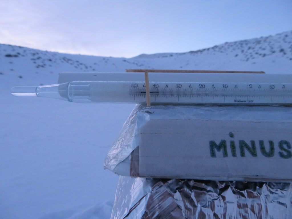
-One meteorological alcohol minimum thermometer, USSR, 1988, with the measuring range between -50, +40 degrees Celsius.
-One photo camera tripod serving as the support for the instrument.

To be continued…

As I found the tripod with the instruments fallen over and partially buried under the snow on June 27, I had to found out when this happened. Analyzing the graph I noticed a remarkably elevated maximum temperature of 16.8 degrees Celsius in the early afternoon of June 22. That’s definitively an impossible value at these altitudes. The certitude regarding this conclusion is confirmed by the extreme fluctuation what happened shortly afterwards, when in a matter of a single hour the temperature dropped more than 14 degrees than rised again more than 10 degrees.
This would certainly not happen if the sensor was properly sheltered in the radiation shield. Here the sensor was over-exposed and the extreme temperature change must be caused by alternating windy and calm periods. So the fall over happened before. But when?

The first two days (when I was present in the region) are excluded. At the time the weather was fine, without even moderate wind. The temperature curve of this period is also realistic. Going a little ahead the things started to make sense. In the night of 21-22 the temperature was suspiciously high and constant (between -1 and -5 degrees). This can happen here only during very cloudy or windy weather (or both). And in the next day was the dubious 16.8 degrees maximum. Puzzle solved.
On the other hand in the last 4 days the maximums didn’t climbed above 0 degrees. This is probably because the sensor became snow covered. As the minimums of these days are quite low (approaching -20 degrees) and the temperature curves are looking regular I suppose the weather was again clear and not very windy (at least in the night).
After this short detective work let’s go back to the scientific evaluation. We have only 2 days to take in consideration as having valid datas:
June 20: This first day was the luckiest with both the lowest (-26.6 degrees Celsius) and highest (4.0 degrees Celsius) temperatures, respectively the biggest daily thermal amplitude (30.6 degrees).

During this interval happened a temperature rise of 12.7 degrees in 60 minutes and 6.7 degrees in 15 minutes.
Even if the weather station started its activity more than an hour after the astronomical sunrise, because the crater’s bottom was still in shade the inversion wasn’t affected before the sun reached the lowest elevations. This fact can be clearly seen in the graph, where the temperature remains almost uncheanched between 8:21 and 8:51. The minimum was registered at 8:36 AM.

Then the temperature started to rise very fast and in less than 3 hours and a half climbed to +4 degrees, the maximum of the day. What’s interesting this happened pretty soon, just after midday. In the early afternoon the curve became close to an isotherma, remaining mainly around 2-2.5 degrees Celsius. In the latter part of the afternoon the temperature started to plummet and the vigorous fall continued during the evening hours. I was not present in the crater in this warmest period, but the extreme temperature rise was obvious also outside. It was absolutely no wind even at noon. A light breeze started after 1 PM. This explains why the maximum was registered at 12:16 PM.
June 21: The temperature dropped to -22.1 degrees Celsius in the morning at 7:46 AM. The sharp rise started again just before 9 AM and continued to the noon when reached 3.7 degrees, the days maximum. You can observe an outstanding upward curve during the first part of the night when the temperature rised from -16 to -5 degrees before starting to plummet again. It means even light winds can seriously disturb the night inversions in the basin. The amplitude for this day is 25.8 degrees, quite big, but significantly less than the first days’s 30.6 degrees. The night was clear again, but sometimes I noticed a light breeze at my camp (the same place, around 6 km’s from the crater). The near surface temperature was also less low than in the first night (more than 5 degrees milder). There were some cirrus clouds in the morning. I was present in the surroundings to around 3 PM and the weather was comparable with the day before: sunny, calm or light winds and quite warm for these elevations.
-If the weather is clear and calm the inversion layer in the crater is thick (filling completely the endorheic basin).
-During ideal conditions the lowest temperatures occur around 8-8:30 AM. The inversion is destroyed only well after the astronomical sunrise, when the sun reaches the bottom of the caldera.
-When is partial snow cover the head level air temperature above the snowy part is much closer to the ground level temperature above the uncovered part than to the snow surface temperature just below. The minimum temperatures above the snow surface are much lower than in the air above (up to 8-9 degrees difference).
-Because the first air movements usually start after midday the maximums are registered around noon when the heating of the ground is at peak levels.
-Clear skies are prevalent in the area during winter, but the calm conditions are much rarer. Strong winds (mainly westerly) blow often even at the crater’s bottom.
-The nights and mornings have more calm periods, the afternoon beeing the windiest part of the day.
-During windy weather the night minimums are significantly warmer (up to 20 degrees Celsius).
-The cooling period has a much longer curve than the warming period. The steepest parts of the graph are the ones just after the sun reaches the depression’s bottom, but it continues quite abrupt to the noon without major changes.
-The daily thermal amplitude can exceed 30 degrees, producing probably one of the biggest fluctuations in the entire world. *
-The minimums can go down well below -25 degrees (very likely also below -30 in certain conditions), lower than the current bolivian national record (-31 degrees Celsius) and maybe than any other official temperature measured between the tropics.
*The actual world record for the highest amplitude in 24 hours is more than 55 degrees Celsius and it was observed in Browning, Montana-USA. However this is a completely different kind of temperature change as the big difference was caused by a sudden change in the weather conditions and not by the pure physical potential of the local air.
After the return to La Paz I visited the National Meteorological & Hydrological Service of Bolivia. There I found out some important datas:
-The lowest official temperature ever measured in a bolivian settlement is -25.7 degrees and it was registered in Uyuni (around 3700 meters elevation).
-The lowest official temperature ever measured in Bolivia is -31 degrees and it was registered at Laguna Colorada Weather Station in May 1992, close to the lake with the same name (around 4300 meters elevation).
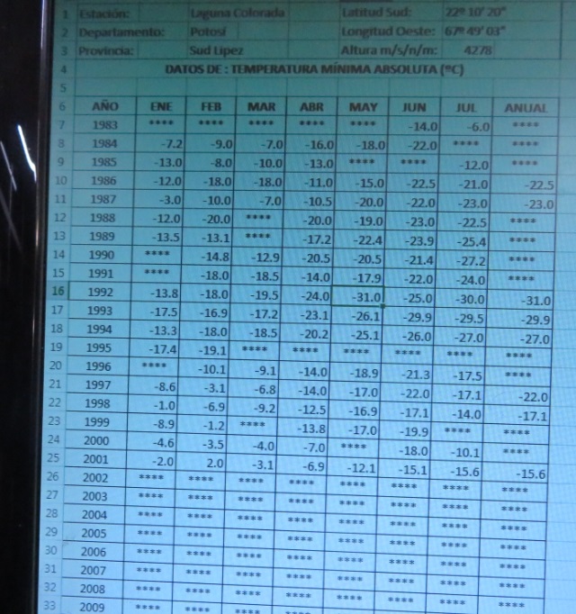
-On 20 June 2018, when my logger recorded -26.6 in the crater of Aguita Brava volcano the minimum temperature in Uyuni was -9.4 degrees Celsius. Unfortunately they have no infos about Laguna Colorada for the same day. They only sometimes get datas from there. My guess is when those -25.7 and -31 degrees happened it was continuous snow cover in both locations. The difference between a -9.4 and a -25.7 degrees is enormous and can’t be explained otherwise, taking in consideration the weather was constantly clear and even windless on 20 June 2018.

In the period of my staying it was no snow cover in Uyuni nor in any other place in the country situated below 4000 meters and the satellite datas showed the immediate surroundings of Laguna Colorada it was also free of snow. Definitely out of question to go even close to -31 degrees under these circumstances. During my visit the caldera was only partially snow covered and still went down to -26.6 degrees Celsius and close to the snow surface even much lower (-35 degrees). Interestingly the temperature close to the uncovered surface was about the same as the air at head level above the snow. I have no doubt if the same atmospheric conditions are present and there is continuous snow cover in the crater the minimum would go well below -30 degrees, surpassing the lowest official bolivian temperature.
To my knowledge beside Laguna Colorada there is a single place situated on tropical latitudes where the temperature plummeted below -30 degrees. It’s Ollagüe in Chile with -37 degrees Celsius. This is the lowest temperature measured between the tropics what I found on the net. Ollagüe settlement is situated right on the border with Bolivia, but it is also a high volcano named Ollagüe nearby. The village’s elevation is similar with Uyuni’s and much lower than Laguna Colorada’s, so a -37 degrees there is a little dubious for me. Maybe it was registered somewhere on the volcano? Is this data reliable at all? Maybe it was only -27? It looks much more realistic for a place situated at 3700 meters elevation at these latitudes. However, until solid facts reveal the truth this remains an open question.
In my opinion the crater of Aguita Brava is a strong canditate for both the titles “the tropical pole of cold” and “the pole of diurnal thermal amplitudes”.

**********************************************************************************************************************


To be continued…
Bolivia is situated in the Southern Hemisphere on tropical latitudes, but it’s western part’s high elevation make the closure to the Equator no more than pure statistics. With around 3600 meters altitude in the center area, La Paz is the world’s most elevated capital city. Contrary to the usual setting, here the airport is situated well above the city itself, therefore at 4000 meters elevation the air in El Alto (spanish for “The Heights”) is even thinner. The explanation is the local topography: La Paz is sheltered in a deep canyon, below the wind-swept Altiplano (“High Plateau”) where the flatter terrain is more suitable for an airport.
If somebody came here from normal elevations he/ she certainly will feel some signs of the “mountain sickness” in just a couple of hours. This include headache, nausea, dizziness, tinglings in the limbs and shortness of breath. The last one is very obvious while doing some effort, like climbing the steeper streets of the city. As the urban agglomeration has a very complicated relief you have a lot of inclined terrain to deal with. Better take it easy in the first days. However, some people acclimatize much easier than others. It’s more a genetic thing than something related to physical fitness.
Another interesting fact regarding the local climate are the big daily thermal fluctuations. This is the most outstanding in the dry season, which here coincides with the (austral) winter months. From June to August the temperature tipically fluctuates from near freezing in the night/ morning to 15-20 degrees Celsius in the early afternoon hours. But, because of the high UV radiation the daytime temperatures felt much warmer. A 17-18 degrees Celsius in the sun here on the Altiplano is more like a 25 degrees at sea level. Really sharp contrast between the sun and shade. The sky is normally clear or partially covered with higher clouds, the possibility for any kind of precipitation is pretty low in the winter months.
Despite the lack of oxygen the streets of La Paz and the neighbouring El Alto are very crowded. From food to clothes and car parts, everybody is selling something. The traffic can be incredibly slow, but the locals are very patient and peaceful. Conflicts between the citizens are rare. Tourism is one of the main income in this poor, landlocked south-american country, so you will see lots of backpackers wandering in the center area.

Everybody heard about the expressions “lunar”, respectively “martian landscape”. It refers to a very dry and barren place, usually a desert, where no vegetation is present and the terrain is mostly made of by bare rocks and/ or clay. It is also known that because of the lack of an atmosphere the climate of the Moon and the Mars is very severe, fluctuating between extreme cold in the night and blistering heat in the daytime. This is mostly because of the lack of water vapour in the air, whose presence regulate/ moderate the heat transfer on Earth’s surface. However there are some places on our planet where the climatic conditions remind of these dead celestial bodies, presenting huge daily temperature fluctuations. Where are they and which parameters are responsible for the most extreme conditions on Earth?
First you need clear skies. Clouds are composed of water vapour, which keeps the heat trapped in the lower atmospheric layers. Deserts are known to have less cloudy days than any other ecosystems. Second you need high altitudes. The thinner the atmosphere, the less heat can be kept inside during the nights and more solar radiation will reach the surface during daytime. So high elevation deserts are better suited than the ones situated near sea level*. Thirdly you need high solar angle to have even greater differences between day and nightime conditions. It means high elevation tropical deserts are the best choice. And fourthly you need concave topography, because it heats more in the daytime (reradiation from the sides) and cools more in the night hours (collecting the denser, colder air like a bowl). The theory is ready, let’s check the practical availabilities.
![]()
How about the Altiplano? It is dry, it is very high, it is situated on tropical latitudes and there are many non-active volcanoes with well preserved, deep craters. All the four conditions matches. Reliable climatic statistics of the region are pretty scarse on the Internet. On wordclimate.com I’ve found La Quiaca weather station on the Argentina-Bolivia border (around 3400 meters elevation) to have the biggest average daily amplitude. Here in June and July the temperature fluctuates between -7 and +15 degrees. Regarding the precipitations the western part of the high plateau is even drier, so I suppose the thermal amplitudes can be even greater in the region situated around the triple border between Argentina, Bolivia and Chile, known as “Puna de Atacama”.
One of the biggest astronomical observatories in the world have been built on the chilean side of the Atacama Plateau. Why? Because the region offers one of the clearest skies on Earth, year round. It is said the air here has comparable transparence with the one above the South Pole. After studying the local conditions from the weather statistics of the ALMA observatory I’ve concluded the biggest drawback of the regions climate is the wind. Air movements are mixing the layers, destroying the forming inversions in the nightime and cooling the ground in the daytime. Beside its dryness, the winter is also pretty windy on the Altiplano. So, apart from the already mentioned four, I will need also a fifth parameter: Luck.

But where exactly can be the place with the highest daily thermal amplitude? After stopping at Juriques volcano on the Chile-Bolivia border, finally I decided to choose a lesser known crater situated a little more to the north on the bolivian side. The mountain is named “Aguita Brava”. The location is marked only on good topographical maps. The barren volcano is close to 5500 meters high with a crater of around 800 meters wide and 80 meters deep. The bottom of the caldera is situated at 5320 meters elevation. Because this mountain has a somewhat less prominent topography than Juriques, which rises abruptly above the Atacama desert with little protection from the dominant, westerly winds, I presume Aguita Brava crater has better chances to produce good night-time inversions. The caldera itself is also a little more sheltered inside the volcano, with slightly lower, but still enough good sky view factor (around 0.91-0.92, according to my calculations on Google Earth).

Winter is the dry season here, it means more clear skies and greater chances to have huge daily amplitudes. Even if rare, but snowfall is possible during the colder months too. In the frigid and bone-dry conditions the snow doesn’t melt, but sublimates (transforms directly from the solid to the gas phase). Under the strong sun the white blanket wanishes rapidly, however the wind collects the snow in the sheltered areas, often blocking parts of the roads on the high plateau. Timing: second part of June.
Access to the volcano: There are only a few roads in this remote area and none of them is paved. Despite the place is almost uninhabited I found out there are some touristic circuits, which approaches my target pretty well. Around 10 km’s to the north of the crater is an attraction composed of many small geysers named “Sol de Manana”. This place is situated close to the highest part of the Uyuni-San Pedro de Atacama (Bolivia-Chile) road, and when the conditions permits (no snow blockages) has daily visitors year round. The geysers are situated above 4800 meters elevation, only 600-700 meters below my chosen mountain. Properly acclimated this means a one day hike, though with a heavy backpack can probably be quite exhausting.

Aguita Brava is situated inside the Eduardo Avaroa Andean Fauna National Reserve, a protected area with many bird species, including flamingoes. These can survive in the harsh conditions thanks to the salt lakes like the reddish Laguna Colorada, where they eat the alges. Laguna Verde is another local attraction, but this lake supports no life, because of the arsenic content. The green color is given by the copper minerals and is more intense during windy weather. Licancabur volcano rises above the surreal lake, where the highest level of UV radiation on Earth (43.3) has been measured. Though this was registered during the summer, because of the tropical latitudes the sun has a pretty high angle even during midwinter and the clear skies – thin atmosphere combination gives a solid recipe for sunburn if unprotected.
*The rumour about the Sahara to have freezing temperatures during the nights and up to 50 degrees in the daytime during a single day is a very prevalent false myth on the net and school books too, actually probably a misunderstanding. The truth is in the winter nights the temperature can go sometimes below 0 degrees and in the hottest summer afternoons can approach 50 degrees. But when there is freezing in the night, the daytime highs will probably reach around 20 degrees and when the afternoon heat is close to 50 degrees, it is unlikely to cool down below 20-25 degrees in the following night.
My plane landed in El Alto on June 16 in the morning. I spent only 2 days in La Paz before taking the domestic flight to Uyuni. Because of a recent snowfall in the high Andes the usual touristic circuits were not fully open and the approach to the geysers area in the next days (my starting point) was questioned. The company that I contacted from home gave me a private driver to take me nearby the fumaroles in a single day. Though the road was partially snow covered in the last quarter, but we managed to get very close to Sol de Manana without any problems.

From this place (4850 meters elevation) I left the car and started the slow hike up the mountain (10-12 km farther to the south). I set up my camp in the afternoon on the volcanic plateau slightly below 5000 meters altitude. No tent, only bivy sack + sleeping bag, sheltered behind a boulder. I was battling mountain sickness, but the weather conditions were very good (clear skies and no wind) during the night. Feeling better I climbed the mountain in the dark. Before the sun reached the bottom of the caldera I was there and soon the mini weather station started his activity (June 20, before 8:30 AM). The coordinates of the study area are: 22.30.762′ S, 67.47.744′ W, the altitude is around 5320 meters.

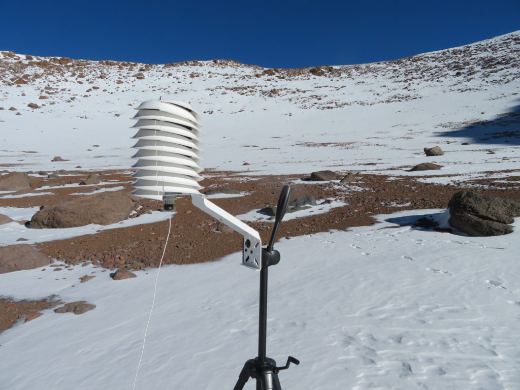
The logger’s sensor was set inside the helical radiation shield (donated by Barani Design Technologies) around 170 cm height, mounted on the top of a photo camera tripod. The logger itself was packed in a plastic bag and sheltered under the snow to protect it from the extreme cold in the night. The device recorded a temperature value every 5 minutes from the time it was started. I left there also an alcohol minimum thermometer to measure the lowest temperature of the entire research period (mostly for the case if the logger will have some trouble). A precision electronic device was used for instant measurements.

I collected the equipment 7 days later (June 27, around 1 PM), when unfortunately I found the tripod with the devices fallen over and partially buried under the snow.
During the research period the sky was generally clear or partially covered by higher clouds, but some of the days were very windy. The first day was my lucky strike, when I had perfect conditions for strong inversions and extreme daily amplitudes. After the second day the weather became more unstable (but without new snowfall) and (concluding from the logger’s graph) probably during the following night the tripod fell down. On 27 at midday when I collected the equipment it was strong gale on the crater’s rim and surprisingly even at the bottom.

The caldera was partially covered by snow during both visits, the ratio between the covered and uncovered parts was around fifty-fifty. The snow below the tripod was 20-25 cm deep, but just a few meters farther it was completely missing.
The lowest temperature registered by the logger during the one week research period was -26.6 degrees Celsius, the highest (reliable) +4 degrees Celsius, giving also the biggest daily thermal
amplitude : 30.6 degrees. Close to the snow surface I recorded -34.3 degrees with the precision electronic device (instant measurement) and below -35 with the alcohol minimum thermometer.
I spent 3 nights on the mountain, two nights on the first research trip (same camp between the geysers and the peak twice) and one night on the last one (on the other side of the crater at similar 5000 meters elevation on the volcanic plateau), visiting the caldera only two times (first in the morning of June 20 and finally in the early afternoon of June 27). The days between I spent in a hostel in Uyuni settlement and on the other side of the Salar de Uyuni, around 250-300 km’s to the north.

There are no settlements in the area, only a mine some km’s farther on the road from the geysers. The crater is completely lifeless, but the highest plants (small yellow patches) can reach around 5200 meters elevation on the slopes of the volcano. I’ve also spotted some seagull-like birds above my camp and vicunas not far from the fumaroles.
-One LogTag Tred30-7R data logger with the measuring range between -40 and +99 degrees Celsius, an accuracy of 0.5 degrees Celsius and a resolution of 0.1 degrees Celsius.
-One Greisinger GMH 2710-T digital precision thermometer with the measuring range between -199.9, +200 degrees Celsius, an accuracy of +-0.1 degrees Celsius and a resolution of 0.1 degrees Celsius.
-One meteorological alcohol minimum thermometer, USSR, 1988, with the measuring range between -50, +40 degrees Celsius (the first dash corresponds to -52.5 degrees).
-One photo camera tripod serving as the support for the instruments.
-One helical solar radiation shield from Barani Design Technologies: https://www.baranidesign.com/
To be continued…

Post factum I found out that the effectiveness of the home-built radiation shield was not satisfactory, therefore I will analyse only the intervals when the logger wasn’t exposed to the direct sunshine. This means to skip approximately the 11 AM – 4 PM period (5 AM – 10 AM on the diagram above, because of the 6 hour time difference).
First night (17-18 January)
The temperature was decreasing fast in the evening between 7:13 PM – 9:23 PM, from -19.2 to -30.6 degrees Celsius. After this it was a short warming up to 10:33 PM when it reached -28.0 degrees. Around this time I was outside my tent and have seen no clouds on the sky. Also it was a complete lack of wind at the bottom of the hollow and only ocasionally some mild air movements on the rim. Between 10:33 PM – 1:53 AM the temperature have plummeted fast again and have reached -36.0 degrees, which is the lowest temperature for the entire night. From here to 4:43 AM it was an abrupt and significant warming period when the temperature have climbed to -18.6 degrees. I haven’t observed an appreciable cloud coverage or more than light air movements at my tent in this period too, however as I have watched the sky only a few times, I can’t exclude a temporary altocumulus invasion. I have seen these types of clouds present on the sky, but were always occupying way less then one half of the total part. After 5:13 AM the temperature have decreased fast again and have reached a secondary minimum of -33.0 degrees at 9:53 AM. I was present at the bottom of the hollow from around 8:30 AM until some minutes after 9 AM and have seen the sky partially covered by cirrus and thin altocumulus clouds. On the graph there is a short warming of 1-2 degrees which coincides exactly with the period when I was there and have checked the logger, so this lil temperature change was probably caused by my influence. Shortly after 9 AM I left the depression and have returned only in 21 January in the afternoon.
Second night (18-19 January)
The graph’s curve plummeted to -33.4 degrees Celsius at 7 PM. This will remain the lowest temperature for the entire night, as from here starts a considerable and long warming period with more abrupt fluctuations, reaching a maximum of -20.0 degrees at 6:23 AM. Then the temperature decreases fast until 8:43 AM when it reaches a secondary minimum of -32.4 degrees. The following short warming increases the temperature to -26.5 degrees at 9:33 AM, but then plummets back to -31.3 degrees at 10:53 AM. Around this time reaches the sunshine first the bowl’s bottom, therefore the 10:43-10:53 period always marks the start of an abrupt temperature rising (valid for all research days).
These first 2 nights have a less regular temperature curve with some striking and considerable warming sections. As I haven’t observed any semnificative cloud coverage (outside cirrostratus) in this period, I suspect that the major cause of these abrupt night fluctuations are rather air movements/ mixing than overcasting. My residence in Erdenekhairkhan was quite close to the research camp (less than 20 km in direct line) so even in the days when I wasn’t present I could appreciate pretty well the general conditions of the sky above.
Third night (19-20 January)
In the afternoon the temperature started an abrupt drop which continues into the late evening when it reaches -39.5 degrees at 10:43 PM, the lowest temperature for the entire night. From here the curve became atypical but without semnificative changings, fluctuating between -36.5 degrees and -39.3 degrees during the entire night period.
Fourth night (20-21 January)
In the late afternoon and early evening hours the temperature decreases abruptly to -36.1 degrees at 7:13 PM. From there is a one hour intense warming to -31.3 degrees than the temperature will start to fall again and (with some smaller fluctuations) will reach a minimum of -43.8 degrees at 8:53 AM, the lowest for this night.
After 3 PM I reached the frost hollow’s bottom again.
In the morning of 21 the sky was partially covered by cirrus clouds and this setting will continue to define the entire day. From the afternoon to the early evening there is an abrupt drop when the temperature reaches -40.9 degrees at 7:43 PM. Then follows a significant 1.5 hours warming when it climbs to -31.3 degrees at 9:13 PM. That’s almost 10 degrees. Shortly afterwards the drop continues again and reaches the lowest temperature of this night at 5:43 AM: -46.7 degrees Celsius. From there the curve is atypical but with smaller fluctuations, remaining in the morning hours between -44.7 and -45.9 degrees. I was present at the hollow’s bottom during the morning between 8:40 and 9:45 AM and I was checking the logger just before leaving. This coincides exactly with the sharp leap on the graph when the temperature rises to -37.9 degrees at 9:43 AM. This peaky segment was definetely caused by my intervention. In the morning the sky was partially covered by cirrus and cirrostratus clouds. In the night before I haven’t observed clouds at any time when I was outside my tent. (Note: Thin cirrus clouds are not visible at night, especially without moon.) I had left the camp on this day after 11:30 AM and will return here 2 days later, in the afternoon of 24 January.
Sixth night (22-23 January)
From the afternoon there is a very abrupt and significant decreasing of the temperature up to 1:13 AM when it will reach -49.5 degrees, the night’s minimum. From here the night’s curve became atypical but without big differences, fluctuating between -46.5 and -48.4 degrees in the second part of the night, respectively the morning hours.
Seventh night (23-24 January)
After 3:43 PM the temperature starts to drop abruptly and continues to drop quite strong even in the middle and second part of the night. I consider this night curve the closest to the ideal one between all 8 cases. At the same time it had also reached the absolute lowest temperature of the entire research period: -53.0 degrees at 8:33 AM. Outside 21 January it is the single day when the minimum temperature was registered in the dawn period, when a night minimum normally is expected to occur.

Eighth (last) night (24-25 January)
This day was the clearest and also the calmest between all eight days, therefore the temperature curves are the most representative for a frost hollow in ideal conditions. I have not seen any clouds on the sky during the entire day, not even thin cirruses. The night was full of stars, without any air movement. The sharp temperature drop what started in the afternoon continued until the first part of the night when at 1:53 AM have reached the night’s minimum, -50.3 degrees. From here there will be very small changes during the remaining part of the night and the following morning hours. This part of the graph is close to an isotherm. As the highest registered value between 12 AM and 10 AM was -48.9 degrees, the 10 hour amplitude is only 1.4 degrees.
At dawn, when I visited the hollow for the last time, there were some cirrus clouds on the sky. I was present in the depression approximately between 8:45 AM and 10:05 AM. The very last measurement of the logger was influenced certainly by my intervention as I have checked the logger before stopping the entire research activity, so this -42.7 degrees can be excluded from the graph. According to the logger the lowest air temperature what I have personally experienced is -49.8 degrees and it was happening at 9:03 AM, 9:13 AM and 9:33 AM during this last research day.
– The formation of the inversion layer starts just after the place gets into shade and evolves extremely fast in the first 2-3 hours, than the procedure slows down considerably.
– Both the formation and the destruction of the inversion layer takes place in a very short time.
– The formed inversion layer can be easily destroyed during the evening/ night by temporary clouding or mild wind.
– Only 3 out of the 8 night minimums were recorded after 2 AM (but the absolute lowest one is between these 3).
– The temperature decrease is the strongest between 4 PM – 5 PM.
– The temperature increase is the strongest between 11 AM – 12 AM.
– The cooling period has a much longer curve than the warming period, even so the first section of the cooling period’s curve is the same (or more) steep than the first part of the warming period’s curve.
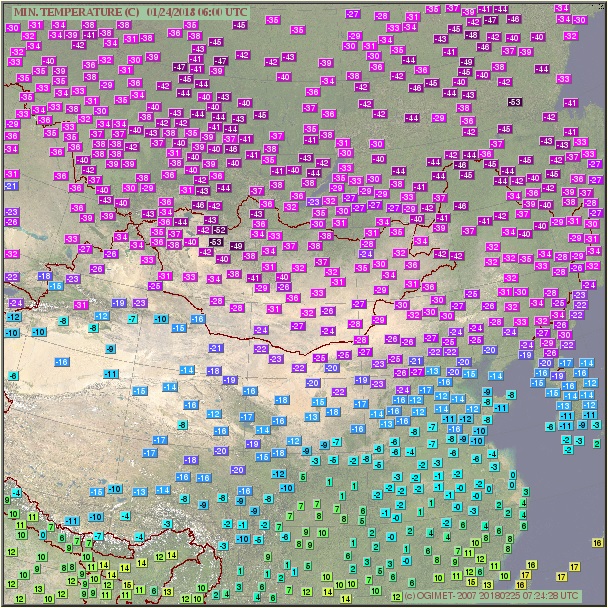
At the weather forecast center in Ulaanbaatar I found out that the coldest temperature in this winter in entire Mongolia was measured in 24 January at Tsetsen Uul and it’s -53.2 degrees Celsius. This value is almost the same with my logger’s absolute minimum (-53.0 degrees) which was registered in the same day. Outside Erdenekhairkhan, Tsetsen Uul is the closest station to my research camp (around 55 km’s in straight line) and it’s also situated at a similar elevation. The snow cover’s thickness during this period was 16 cm there, which is also very similar with the snow conditions at the frost hollow’s bottom, what I approximated to be around 15 cm. Because of it’s slightly convex topography, Erdenekhairkhan reached only -35 degrees on this coldest day. The next lowest temperature is -51.8 degrees, recorded at Bayantes (Gandan Huryee station) three days later in 27 January (the minimum on 24 was -51.7 degrees). Tes from the famous Uvs lake’s basin and Tosontsengel from Zavkhan aimag reached -50 degrees, Otgon and Zuungobi around -48 degrees.

Actually (according to the statistics found on Ogimet) there is only a single station in the entire world, which recorded a lower minimum temperature in 24 January than Tsetsen Uul and my frost hollow. It’s Toko from southern Yakutia with -53.4 degrees Celsius, a very subtle difference. The next closest is Summit station from the middle of Greenland’s ice sheet with -52.2 degrees. Verkhoyansk recorded -43.4 degrees on this day, Ojmjakon even less as the weather was snowy.
During my visits to the frost hollow’s bottom I made some instant temperature measurements with the precision electronic device and also checked the minimum thermometer’s index and alcohol column (keeping both around the same height with the logger). I made some pictures of these measurements which I can compare with the logger’s recordings at the closest time marks.
In 18 January in the morning the minimum thermometer’s index was stopped at -38.5 degrees Celsius. Meanwhile the logger have registered only -36.0 degrees. This will remain the biggest difference between the two devices until the end of the research. As in the first night the loggers mounting permitted more contact between the device and the shield’s interior, I think the difference was intensified by too much isolation on the logger’s side. Therefore I changed the loggers positioning inside the mounting the next day to have the least possible contact between the device and the surrounding material. I also raised a little the uppermost part of the shield to enhance the ventilation.
I consider this change have altered a little the daily temperature recordings as the logger’s uppermost part received some sunshine during certain parts of the day. I made this sacrifice because the night minimum’s accuracy was my first priority.
In 22 January in the morning I found the minimum thermometer’s index stopped at -47.3 degrees Celsius, while the logger registered a night minimum of -46.7 degrees. The difference is much smaller than the previous time (0.6 degrees vs 2.5 degrees), so I consider the changing in the mounting an useful intervention. In this morning I have a picture with my electronic device showing -46.4 degrees at 8:58 AM. The two measurements of the logger taken the closest to this minute are -45.5 and -45.6 degrees. That’s around one degree difference.

In 25 January in the morning I found the minimum thermometer’s index stopped at -52.2 degrees Celsius, while the logger registered a minimum of -50.3 degrees. This is again a bigger difference (1.9 degrees) between the two and it can’t be caused by the mounting. From this morning I have pictures of the electronic device showing -50.7 and -50.5 degrees at 9:00 AM, respectively 9:07 AM. Meanwhile the logger recorded -49.5 and -49.8 degrees Celsius. That’s again the same one degree difference. During this time the minimum thermometer’s alcohol column was showing between -51.5 and -52.0 degrees. This is another one degree difference in the opposite direction of the precision device’s measurement. As this more than one degree difference between the two devices remained constant after the last research day (the alcohol thermometer shows 1-1.5 degrees lower values even at room temperature), I consider the minimum thermometer lost his previous accuracy, when the two instruments had the difference around or less than half degree.
As the digital precision device is the most accurate between the 3 instruments (+-0.1 degrees), I will try to approximate the real absolute minimum of the 8 day research period. Since the electronic device was always measuring around one degree lower temperatures than the logger, in my opinion this value is around -54 degrees Celsius, exceeding even the coldest temperature registered at a mongolian weather station (Tsetsen Uul) in this winter. This corrected value also exceeds the coldest temperature recorded in the entire world in 24 January 2018 (Toko, Russia: -53.4 degrees Celsius) and approaches the absolute lowest temperature measured in Mongolia by around one and a half degrees (the -55.6 degrees Celsius recorded at Zuungobi).
Definitely a successfull journey and a productive research.


To be continued…
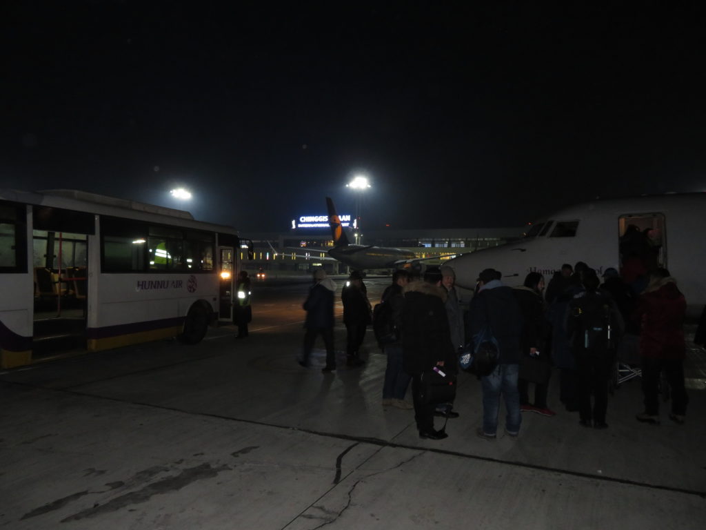
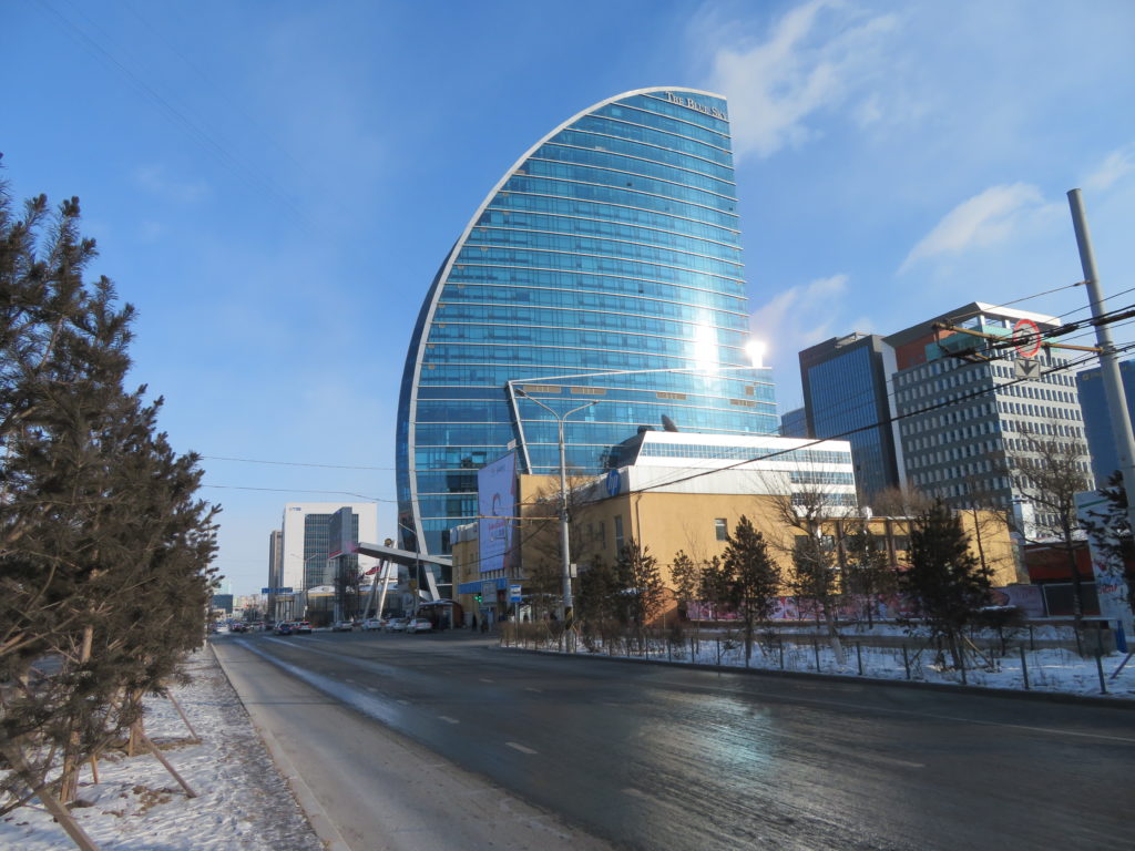
Mongolia is well known as one of the coldest countries in the world and his capital city, Ulaanbaatar is undoubtedly the coldest one. With a January average below -20 degrees Celsius and occasionaly reaching below -40, this place is not for the weaklings. Beside the severe climate the city is enshrouded in heavy smog, making the breathing even more difficult. The pollution is caused by the phenomenon known as “thermal inversion”, when the dense cold air of the wintertime is sinking to the bottom of the valleys and basins keeping the smoke and other dry particles in the lowest atmospheric layers. The smog is the strongest in the late night and early morning hours when the cooling is the most intensive. This can cause many problems including road accidents and flight delays. Because of these complications there are plans to move soon the capital’s airport to a new place that is more than 50 km’s from the city. The actual “Chinggis Khaan” (named after the founder of the Mongolian Empire) airport is situated about 15 km’s from the center and because of its location in a flatter and more open area is even colder than Ulaanbaatar itself. The temperature difference between the two on an average winter morning is around 5-6 degrees Celsius. In the day of my arrival it was a “mild” -25. But we aren’t there yet.

I have a big passion for deserts. But also for the cold. How about the coldest desert? I’ll try to found it.
With an annual average below -50 degrees Celsius and reaching below -80 degrees in the toughest winter days, the interior of Antarctica is unequivocally the coldest place on Earth. It can be considered a desert if your classification is based only on the precipitation ammount which is extremely low there. But if your criterions are more complex and it includes also the landscape component, then you must switch your search to the Northern Hemisphere. Yakutia in Eastern Siberia is the coldest region in the boreal half (also has the coldest permanently inhabited places), but there is only taiga and tundra zone, no deserts. That’s why most sources come up with the Gobi as that one is the biggest and most known example of what a cold desert is. But it’s not the coldest one. The Gobi is situated in the southernmost part of Mongolia (also continues more to the south in neighboring China) but there are some smaller deserts in the north-western part of the country where the winter averages are much lower than in the famous stony desert.
The mean January temperatures in the mongolian Gobi are mainly between -12 and -20 degrees Celsius (Dalanzadgad -15, Sainshand -18 degrees) and in the chinese part mostly between -8 and -15 degrees (Dunhuang -8, Ejin Qi -11 degrees). Pretty low for sure, but not even close to the bone chilling -33 degrees of Ulaangom in Uvs aimag* (local administrative division, similar to province or county). The town is situated in the Uvs Lake’s basin, known as one of the coldest places in Central Asia, not far from the lesser-known Boorog Deliyn Els sandy desert. In this wasteland is a village named “Zuungobi”, which is the place where the lowest temperature in entire Mongolia was measured: -55.6 degrees Celsius. Yeah, that’s cold. And it’s a desert.

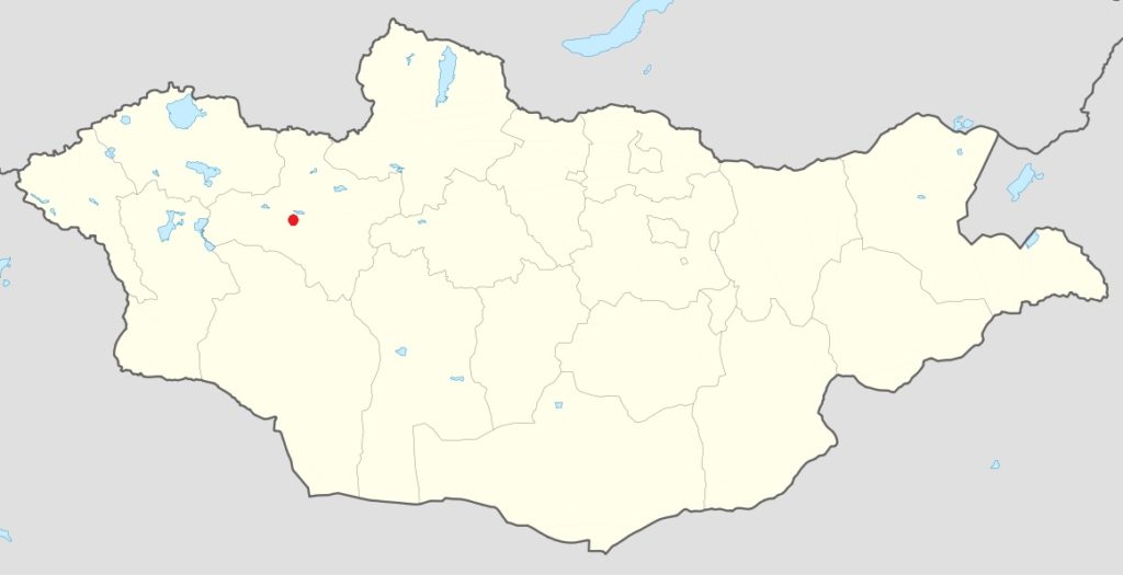
From October to April the land of Genghis Khan is affected by the Siberian Anticyclone, a huge collection of cold and dry air masses that is responsible for both the highest atmospheric pressures and the lowest temperatures in the Northern Hemisphere. Actually the center of the Siberian High in midwinter is in north-western Mongolia, consequently here was recorded the world’s highest barometric pressure. Most Internet sources are claiming that Tosontsengel of Zavkhan aimag holds the title with 1085.7 mb (millibars), but there is a place in the western part of the same aimag which (according to the statistics found on Ogimet) have reached even much higher values, like 1098.7 mb in the morning of 9 March 2016. This occured during an unusually strong cold snap when the small village experienced also the lowest temperature in the country for this month, a staggering -54 degrees Celsius. Tsetsen Uul, the peculiar settlement is located in a high altitude basin in the western part of the Khangai Mountains, not far from the limit of the sandy area, which extends here from the Great Lakes Basin, along the Hungui river and its (mainly former) tributaries. In some parts the sand dunes are reaching 2200-2400 metres in elevation, therefore it can be considered the highest desert in Mongolia. Because this region receives a little more rainfall and has cooler summer climate than the western, lower elevations, in some parts you can see pine trees between the sands. This high altitude sandy area raised my attention and I was starting to speculate if it can be the coldest place in the country, respectively the coldest desert in the world.
Because of the strong thermal inversion caused by the anticyclone, as a general rule, in the mongolian winters the lowest places are the coldest, therefore the Uvs Lake’s basin, which is one of the lowest places in the country (below 800 metres at the bottom), is also one of the coldest places. But the reality is a little more complex as Tosontsengel, Tsetsen Uul and Otgon settlements are all situated at much higher elevations (1700-2150 meters) and despite of this they can cool down to similar or often to even lower values than the formerly mentioned region. The explanation is that all three are situated in valley bottoms, which are collecting the sinking cold air from the nearby mountains. Actually the relative position what matters here, not the altitude itself. What’s more, if sufficiently flat and/ or enclosed, the highest basins can be the coldest ones, as in thinner air the nocturnal heat loss is more powerful. The Uvs Lake’s area is so cold because it’s a deep endorheic hollow, from where the collected cold air can’t escape in any direction. If the same topography could exist at higher elevations it could produce even lower temperatures.

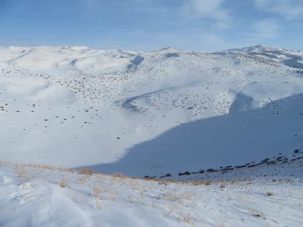
In sandy areas, between the dunes are many enclosed, concave relief forms of different sizes, ranging from 1-2 to more than 50 meters deep. With the help of GoogleEarth I identified some huge hollows on the surface of the high elevation desert mentioned before. Subsequently I obtained a digital elevation model (DEM) of the area which also confirmed that some of these negative shapes are around 50-60 meters deep. The endorheic depth is the altitude difference between the bottom and the “outflow point” (the lowest elevation on the rim). The topographical aspect is exactly the same as in the case of the karstic depressions (dolines and uvalas) which are known to produce extremely low temperatures during clear and calm winter nights, therefore often referred to as “frost hollows”.

Between the deeper concavities noticed on the desertic plateau I picked out one, whose parameters (the combination of elevation and depth) appeared to be the most convenient for my research. The hollow has an endorheic depth of around 50 meters and it’s bottom is situated about 1960 meters above sea level. It has a roughly circular shape with a diameter around 1 km. According to my calculations the average slope of the depression is around 11 degrees. There is a term named “sky view factor” which consider the average slope as the major parameter responsible for the cooling potential of a given topographical place. Concave shapes are important for cooling because they are collecting the sinking cold air and also represents protection from the mixing effect of the wind, but if the slopes are too steep than the nocturnal heat loss will be significantly lessened by reradiation from the sides. Ideal is somewhere in between, mostly like a plate shape: concave but adequately open. By the way, eleven degrees is quite good.

The small negative shape appears on my detailed soviet miliary topographic map but without exact elevation data or a name for this particular place. The desert which encompasses also my target zone is named “Nariyn Golyn Els” (meaning “the sands of the Nariyn river”). No settlements and no roads are present in the immediate surroundings. The closest village is Erdenekhairkhan, situated to the south-west about 19 km in straight line. There is a dirt road which approaches more my target (about 10 km’s), reaching the southern limit of the dune field. I think that’s sufficiently close to can handle it by foot with a heavy backpack. GoogleEarth shows that the surface is sandy with some sparse vegetation (I guess shrubs), probably something like the Kalahari or the australian deserts, but the color of the dunes is lighter not reddish.

My small basin is part of the “Ulaagchiin Khar Nuur Bioreserve”, a protected area of high altitude sands, mountains and pristine lakes. Khar Lake, Mukhart river and Senjit Khad are the main eyemarks of the reserve, but I’m pretty sure that in the wintertime there are no touristic (if any) activities. We’ll see.
I arrived in Mongolia in the morning of 15 January by the Budapest-Ulaanbaatar (through Moscow) international flight. From the mongolian capital I used domestic flight to Zavkhan aimag’s capital, Uliastai. At the airport a private driver was waiting for me, who was contacted by a tourism company from Ulaanbaatar. Previously this company supported me to obtain the visa at the mongolian consulate in Budapest and helped to arrange the transports and accomodations in the country during the entire journey. The private driver is a japanese 4wd car owner and takes me to his home in Erdenekhairkhan (around 110 km’s), which is the closest settlement to my targeted zone. From his village we approached the reseach area with the jeep, following a sandy and quite difficult track through the Nariyn Golin Els desert (around 20 km). We managed to get close to the target around 8 km’s in straight line. From this point I reached the chosen place alone by foot along the dune field, carrying the camping equipment and the meteorological devices in a backpack.

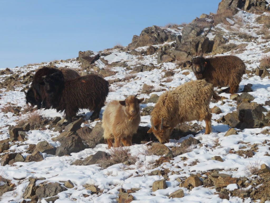
The area is remote, but still have some human activity in the wintertime. I saw 3 yurts and more herds of sheeps and goats along my hikes. Some horses and camels are grazing unsupervised on the dunes. The few people who are living here are moving on horseback and are doing daily circuits with their herds, the yurts are not moved in the cold season. Despite its isolation and severe climate, the desert’s surface was full with animal trails.

I raised my tent some hundreds of meters west from the actual research place, on the lowest part of the selected hollow’s rim, around 2007 meters above sea level. The tripod with the data logger inside the home-built radiation shield was set on the lowest portion of the frost hollow, about 1942 meters above sea level (according to the GPS). It means the depression’s endorheic depth is around 65 meters (16 meters deeper than according to GoogleEarth). The low-point’s exact coordinates are: 48.15.460′ N, 95.52.914′ E. The logger’s elevation above the surface was around 160 cm’s. This device was constantly registering the temperature from the afternoon of 17 January until the morning of 25 January. On the days when I was present in the region (three nights) I have set the minimum alcohol thermometer on the top of the radiation shield to measure the night’s lowest temperature. The precision electronic device was used to take instantaneous measurements of the air (holding the device in hand at head level while moving) and near the surface (leaving the instrument on the snow).

Outside a smaller exposed side from where the snow was partially missing, the depression was snow covered, with around 15 cm of snow at the bottom. The weather was constantly good, mostly clear or partially covered by cirrus and cirrostratus clouds, seldom with transitory altocumulus appearances. The wind was rare and mild, at the bottom mostly completely missing.
The research period was encompassing eight consecutive nights. From this I spent three nights in my tent, the remaining ones in my drivers yurt in Erdenekhairkhan.

-One Alpha TD80 data logger from Tempsen with the measuring range between -80, +70 degrees, an accuracy of +-0.5 degrees Celsius and a resolution of 0.1 degrees Celsius.
-One Greisinger GMH 2710-T digital precision thermometer with the measuring range between -199.9, +200 degrees Celsius, an accuracy of +-0.1 degrees Celsius and a resolution of 0.1 degrees Celsius.
-One meteorological alcohol minimum thermometer, USSR, 1988, with the measuring range between -50, +40 degrees Celsius (the first dash corresponds to -52.5 degrees).
-One photo camera tripod serving as the support for the instruments.
-One home-made radiation shield constituted of superimposed bowls made of polystyrene, covered with aluminum foil.

To be continued…