Interpretation of the logger’s graph (using LogTag Analyzer 3 software)

First day (August 11)
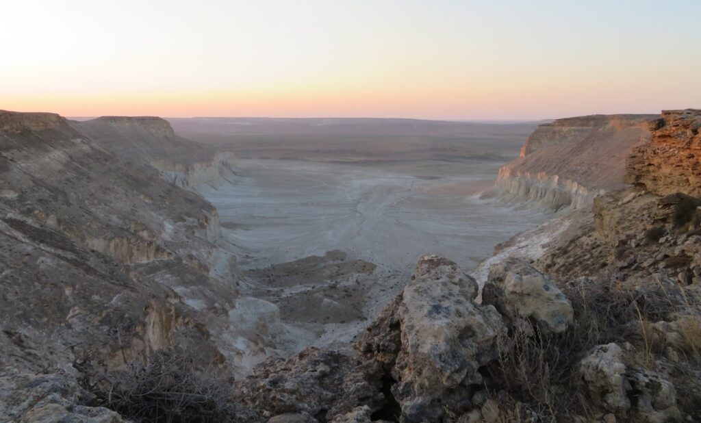
It is the single day when I’ve spent significant time nearby the measuring equipment. During the hike towards the bottom of the depression the sky was completely clear, the wind (easterly) light to moderate and these conditions continued also afterwards the entire day. The data logger started the continuous measurements at 12:42 PM, the first reading was 36.6 degrees Celsius. As I set the device for 2 minutes logging (short intervals) the curve has the typical “saw aspect” with many small ups and downs inside the general “big waves”.

Generally, the temperature was constantly rising until 4:48 PM, when the maximum of 40.1 degrees Celsius was reached. I was present, waiting in a camping chair at that time and observed little to no wind near the tripod in the hottest part of the afternoon. The obvious drop started after 7:30 PM and continued to 11:30 PM when the temperature reached 29.0 C. After that the curve became irregular, reaching the night’s minimum shortly before midnight (28.9 C), later climbing back to 31.6 C. As there were no clouds (I saw the starry sky through the transparent mesh of the mosquito tent), the disturbance was certainly caused by the wind. In the final part of the night, before leaving, I checked again the device and observed 29.9 C at 5:10 AM.
Second day (August 12)
The bulk of this day I’ve spent in Aktau after reaching the city around 11:30 AM, hitchhiking from the Zhanaözen road, north-east from the depression. The completely clear conditions continued, in the afternoon it was markedly hot even near the sea.
The graph shows a very regular diagram during the entire day, the temperature continuously climbed until it reached the maximum (40.6 degrees Celsius) at 3:32 PM, which is also the highest value of the entire measuring period. The earlier peak (maybe) could be attributed to the fact that the wind wasn’t dominantly easterly in the afternoon and the sea breeze could have slightly moderated the farther rise in the mid afternoon.

The obvious drop started again around 7:30 PM and lasted until 11:10 PM, when 28.7 C was reached. A very similar pattern with the previous day & night combo, complemented also with the following irregularity (certainly wind again). The main difference is that this time the minimum went down to 24.5 C in the early morning (5:52 AM).
Third day (August 13)
Today I left Aktau and travelled by train to Shetpe town, where I visited the inselberg named Ayrakty. I reached the area after 3 PM and saw no clouds in the sky during the entire day. In the afternoon I observed 38-39 C (hand measurement) around 70-80 m elevation. The wind was light until the evening (even on the elevated plateau), however in the night became consistently stronger. The sky remained clear.

Likely because the wind became again south-easterly, the maximum (40.6 degrees Celsius for the second time, equaling the previous record) was reached at 4:52 PM, very similar with the first day’s case. The obvious drop now started around 8 PM and except a short disturbance period between 10-11 PM continued pretty constant until the morning (7:02 AM), when reached the minimum of 26.3 C.
Fourth day (August 14)
Starting in the night, this day was a windy one and slightly less hot than the previous three, which were very alike. I hiked in the surroundings of Shetpe (Ayrakty and Sherkala) and observed almost no clouds. In the early afternoon I moved closer to Aktau to the so called “km 43” beach, where the sky became partly cloudy.

The day part of the graph looks quite regular again, reaching the maximum of 38.1 degrees Celsius at 3:50 and 3:58 PM. However, the obvious drop started much sooner this time (sea breeze?), around 5:45 PM and lasted until 9:10 PM, when reached 30.0 degrees. From here the curve is more irregular (I suspect wind again), but generally was descending until the morning, when reached 24.5 C at 6:54 AM.
Fifth day (August 15)
Sleeping on the beach, I continued the hike in the morning towards the road, where I hitchhiked back to Aktau before noon. It was mostly sunny with scattered altocumulus clouds in the city, the temperature less hot than before. The wind was much lighter than yesterday in the Sherkala area.

The daily graph looks normal again, reaching the peak of 36.0 degrees Celsius at 3:54 PM, which is the “weakest” maximum of the entire measuring period. The obvious drop started around 6:45 PM this time and was clean until around 10 PM, when reached 28.0 C. Then the descend became less regular with some abrupt ups and downs during the night, though the general tendency was evidently downwards. The minimum happened at 5:52 AM in the morning and was much lower than the previous ones: 19.3 degrees Celsius.
Sixth day (August 16)
Today I went back to collect the measuring equipment, this time starting the hike from the Kuryk road, situated on the other side of the depression (south-west). In the early afternoon I’ve crossed the entire salt pan transversely, before reaching the weather station. There were some scattered clouds, but overall much more sun than shade. I stopped the logger at 6:40 PM when the screen showed 33.9 degrees Celsius. In this later part of the afternoon I observed some convective rain clouds in the south, south-east, probably between the sea and the basin.

The graph of this day is also pretty regular, but can be discerned a little “rush” as the maximum of 36.4 degrees Celsius was reached sooner than usual: 3:06 PM. I attribute this fact again to the changing wind directions (namely the sea breeze), which started to counteract the afternoon heat.
The average maximum temperature of the six day measuring period is 38.6 C, while the average minimum of the related five nights is 24.7 C, giving a mean amplitude of 13.9 degrees Celsius. This combo is above the level of the hottest places of Europe for the month of July, closer to the Karakum desert in Turkmenistan or south-eastern Turkey around the Syrian border. Though this could not be considered a fixed generality as this summer was hotter on average in many places, especially in the mediterranean basin.
General conclusions
- The sky is usually clear without significant differences between day and night.
- The temperature rise during the daytime is typically constant and regular, reaching the maximum between 3 and 5 PM, sooner in the case with a stronger sea breeze effect.
- The evening and the first part of the night is less windy with a more abrupt and fluid temperature drop than after midnight, when disturbances are characteristic.
- The daily amplitude is medium (11-17 degrees), even slightly small for an arid environment during clear conditions, in part caused by the low elevation, where the thicker atmosphere can trap more heat during the night.
- It’s a markedly hot area compared with its relatively high latitude (43 N), closer to the level of the subtropical deserts.
Comparison with the weather station of Aktau

Situated near the coast, Aktau receives the moderating effect of the Caspian Sea, thus the maximum temps are generally a few degrees lower than the ones registered farther inland during sunny weather. If we compare it (see the Ogimet chart below) with the values of my station in Karagiye, the average difference between the two is 4.4 degrees in favour of the depression. The biggest discrepancy (5.7 degrees) happened on 16th, while the smallest one (2.1 degrees) on 13th August.
This latter small difference was certainly caused by the easterly or south-easterly wind, which annihilated the sea breeze even near the coast, while on other days the city’s atmosphere was moderated by the cooler marine currents. As the low elevation of the depression gives an advantage of 1 degree against the level of Aktau, the measured 38.5 degrees would mean around 39.5 at -130 m, which is only one degree apart from the 40.6 degrees Celsius what I’ve recorded at my station.

Adding the 4.4 degree advantage to the average maximums of Aktau (see the Wikipedia chart) for the months of July and August will give 36.3, respectively 35.3 degrees Celsius average max for Karagiye, while adding the 2 degree difference (easterly dominance) to the 44 degree absolute maximum of the city will give around 46 degrees Celsius as a hypothetical heat record for the depression.
Addition: I’ve checked before the weather statistics of Aktau airport station on the Wunderground site’s history section (now unavailable) and saw that the maximums were 37, 37, 39 degrees Celsius (rounded values) for 11, 12, 13th August. As it is a little farther from the coast than the city, the somewhat higher peaks are understandable.
Comparison with Europe’s hottest areas
Regarding the extreme high temperatures, this summer was one of the most severe from the very start of the reliable meteorological measurements. The extensive heat domes affected the mediterranean area both in July and August during more successions, climbing the mercury of the thermometers to record or near record levels in many places. The most affected areas were the North African coast (Algeria, Tunisia), respectively Sardinia island and southern Spain where the temperature raised to 45-49 degrees Celsius.

This amount of heat is about 10-15 degrees above the average summer maximums of the mentioned areas, concretely at the level of Death Valley or of the Iran-Iraq-Kuweit triple border region, which are the hottest places of the Planet. Taking this into account it can’t be made a conclusive comparison between my study area and Southern Europe in the actual situation. Regarding the broader summer max averages Karagiye is probably alike the hottest areas of Andalusia (thus of entire Europe), which is around 35-37 degrees in July and August, while the absolute record potential could be between 46-48 degrees Celsius, also similar.
Altogether, for a “substitute plan” the research went quite well, both the conditions and the results can be considered decent for the context.