Every year new ice sculptures appear on the Chinggis Square, Ulaanbaatar
Gandan monastery
We are here but the flight is delayed to the next day because of snowstorm in Zavkhan aimag
Arriving at Donoi airport, Uliastai
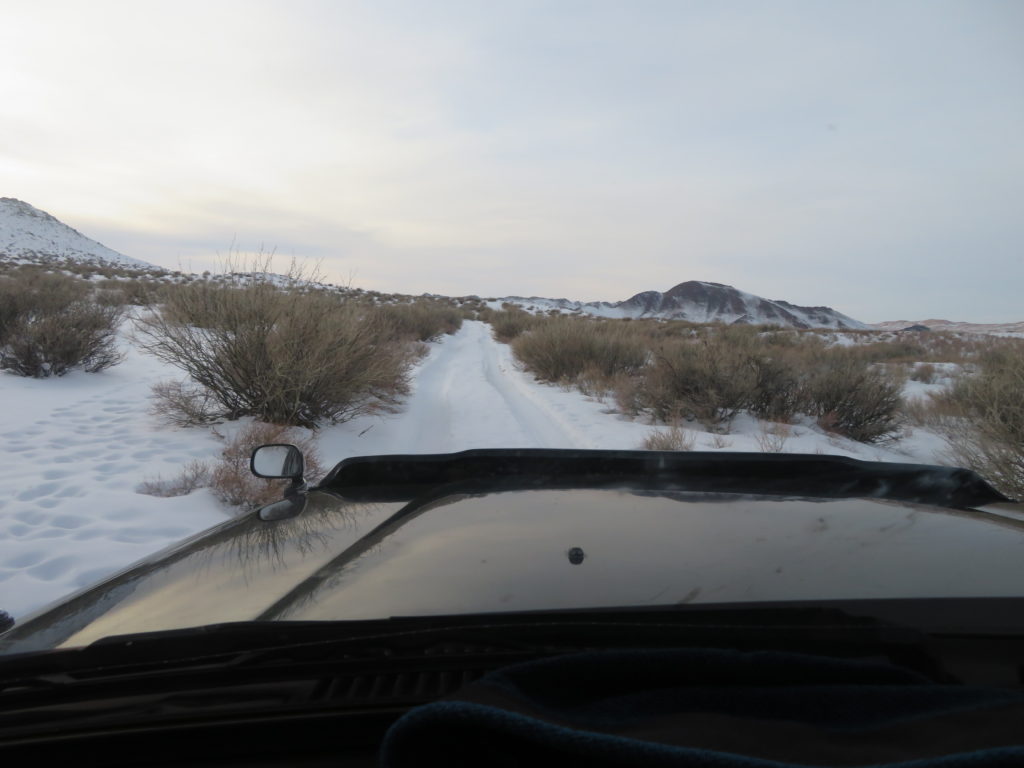
On the way to Erdenekhairkhan (85 km of emptiness)
Arriving in the small village
Maybe this will be my home for the next two weeks
Halo, a very common optical phenomenon in the mongolian winters
Some of my roommates. I think all of us like the cold
Near Mukhart river source in the next morning (30 km snow covered track). This will be the starting point of all my trips to the research area
Pretty chilly, it was -25 degrees in Erdenekhairkhan, which is not a particularly cold place as it lies on a plateau in slope. The next night can be promising
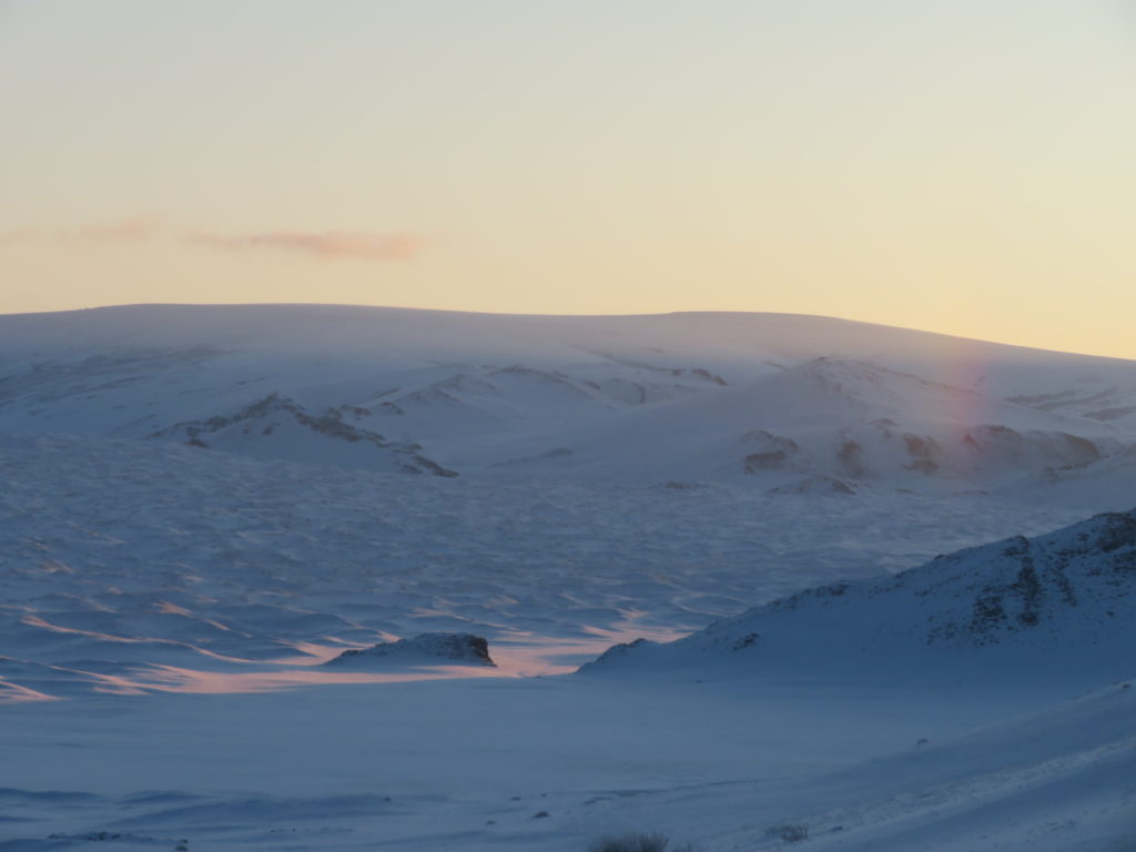
At sunrise, approaching the natural amphitheatrum of Mukhart
Another nice optical phenomenon
I know this scenic place from two years before. One quarter of the way is done
The windchill is playing with my senses
Okay, so that’s my direction. Burgastyn Els desert in front of me
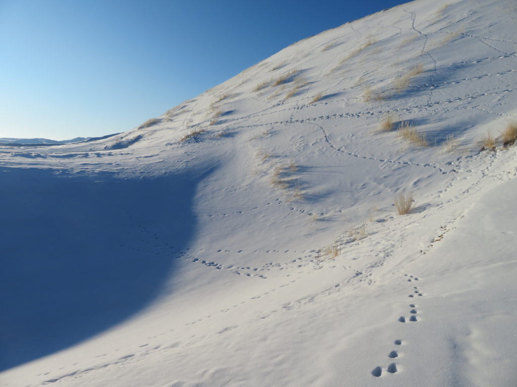
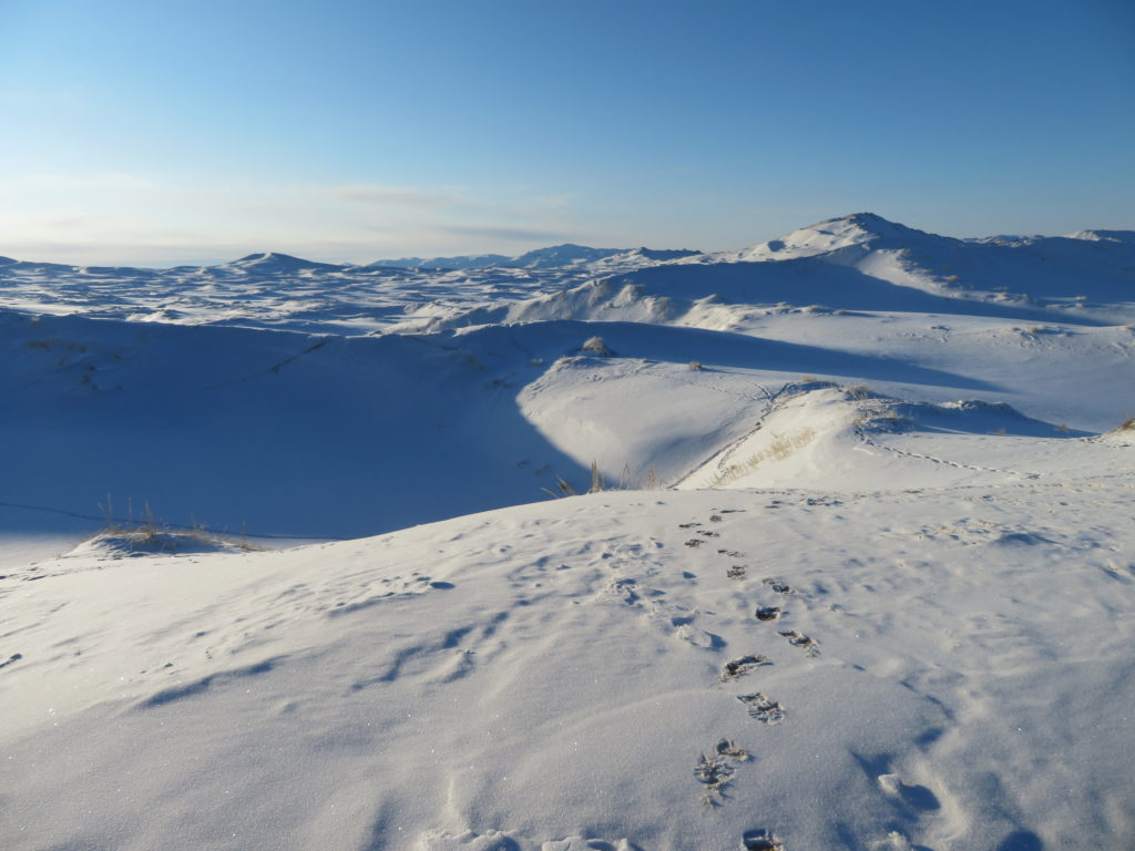
Despite the isolation, the dunes are covered with many animal trails
Looking back, more than half part is done. Pretty tiring terrain for a heavy backpack and big snowboots
Deers are common in this area
But most of the trails are made by these…
…and these guys. Horses and yaks are left to graze on the dunes unsupervised
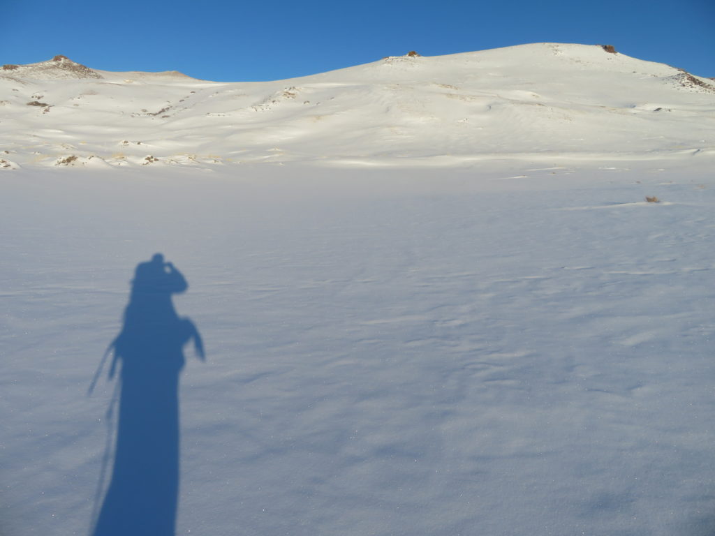
In the afternoon I reached the planned camping spot on the southern col of the chosen basin
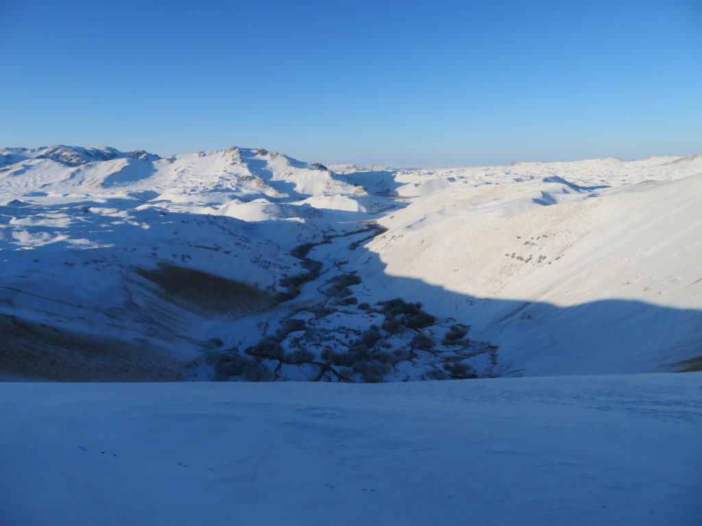
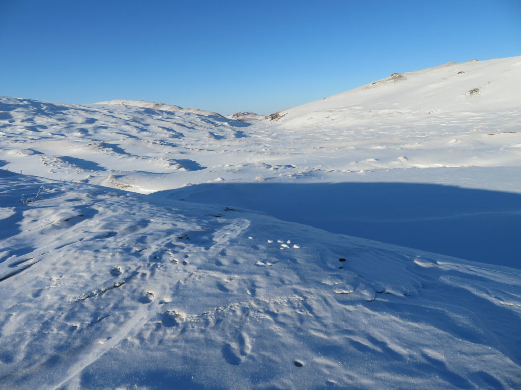
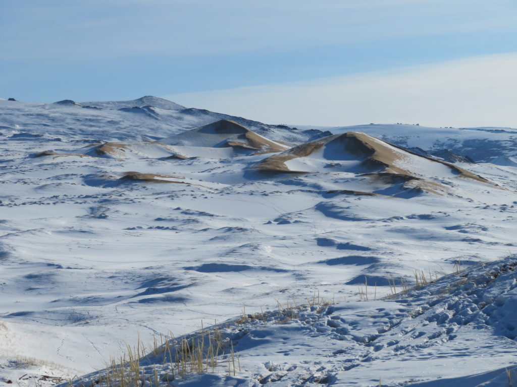
First view of the unnamed sandy depression
Arriving at the bottom. Looks good, the weather also
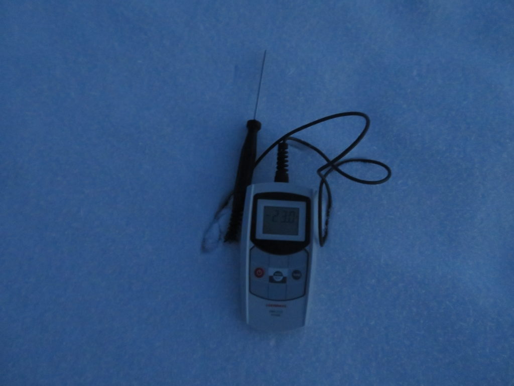
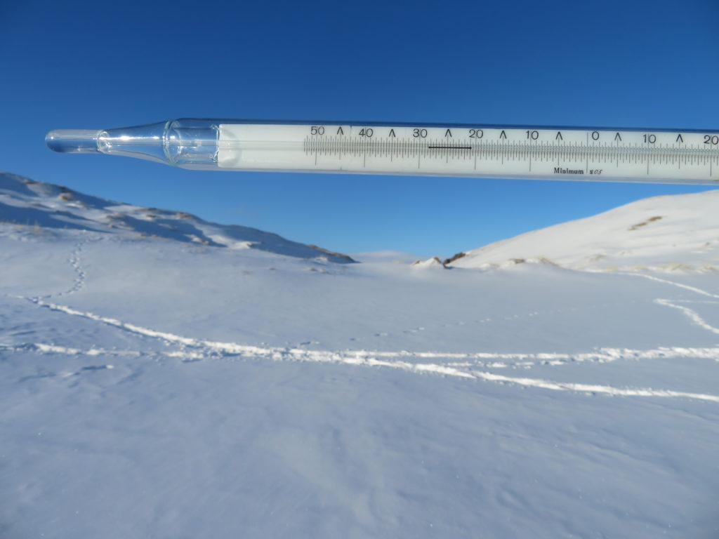
At 5 PM the mini weather station started its activity: -28 degrees now
Soon after the sun disappeared the temperature was falling fast
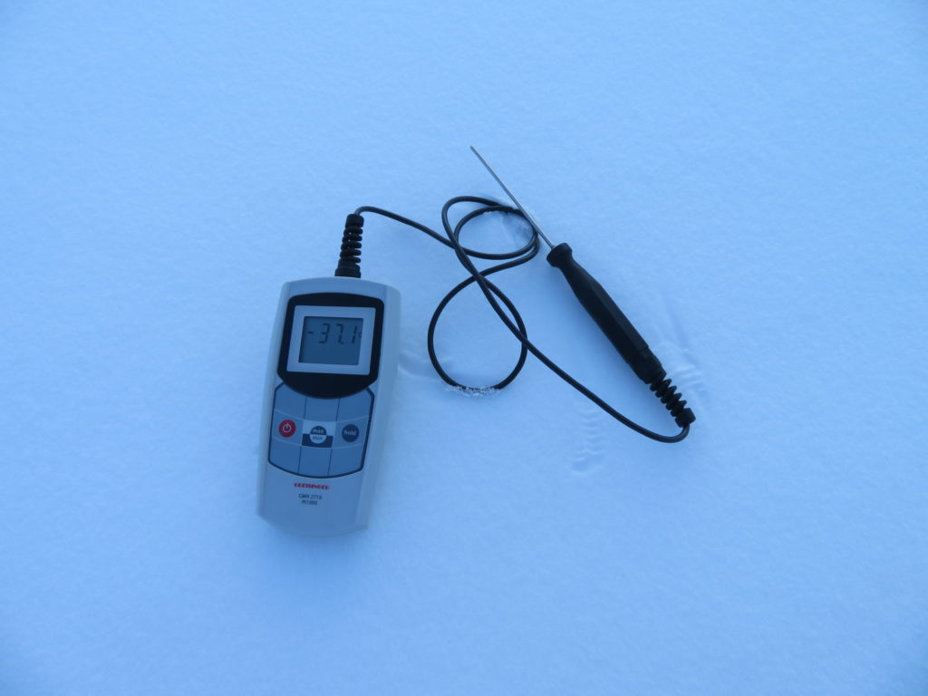
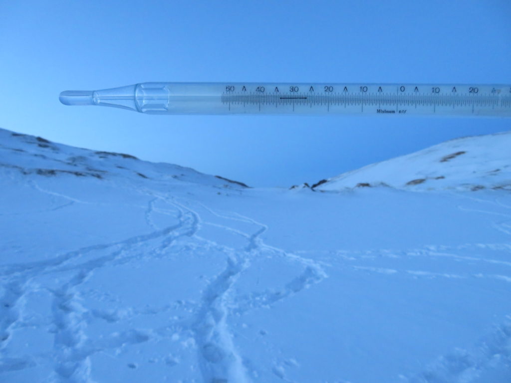
-33.5 degrees at 17:40, still sunshine on the ridges
Time to go back to the tent (1 km in straight line)
Only a thin layer of snow here, the wind cleared the exposed parts. On the bottom is 20-25 cm, but some areas have even above 50 cm
Dinner time: dried fruits, one of the best and simplest solution for extreme cold
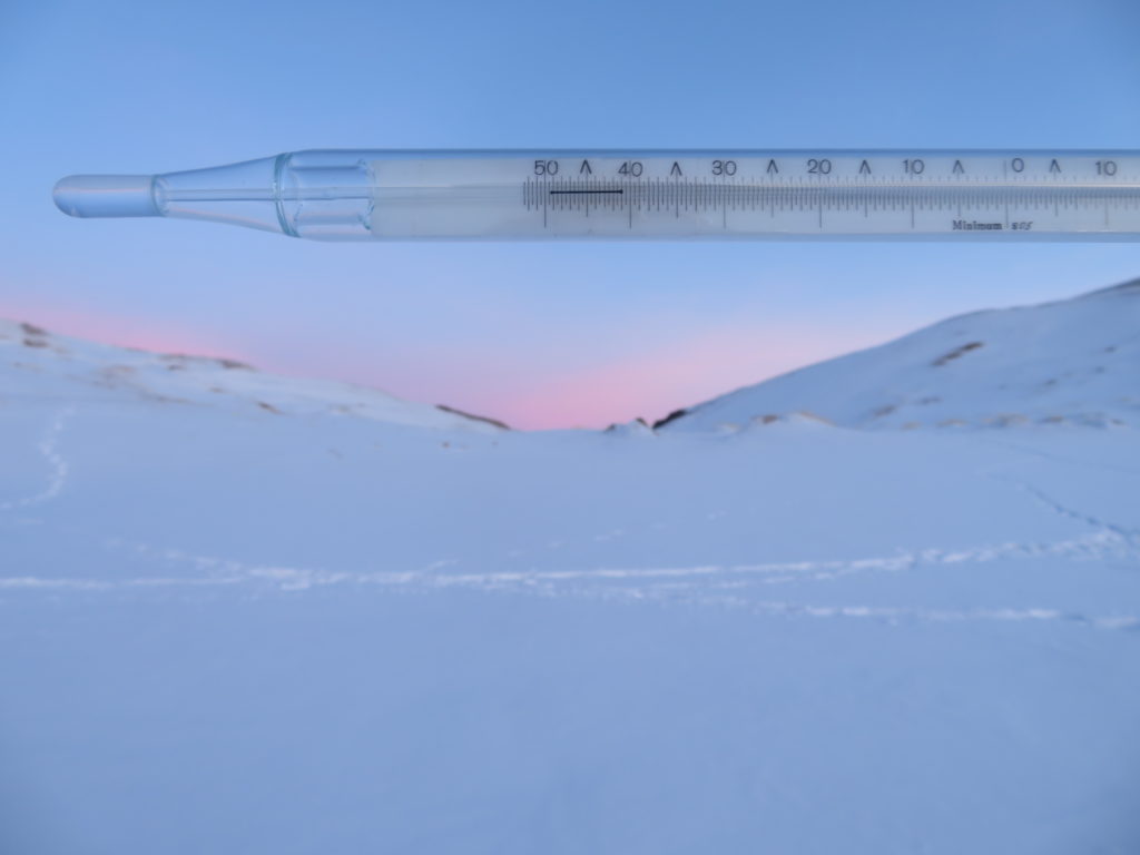
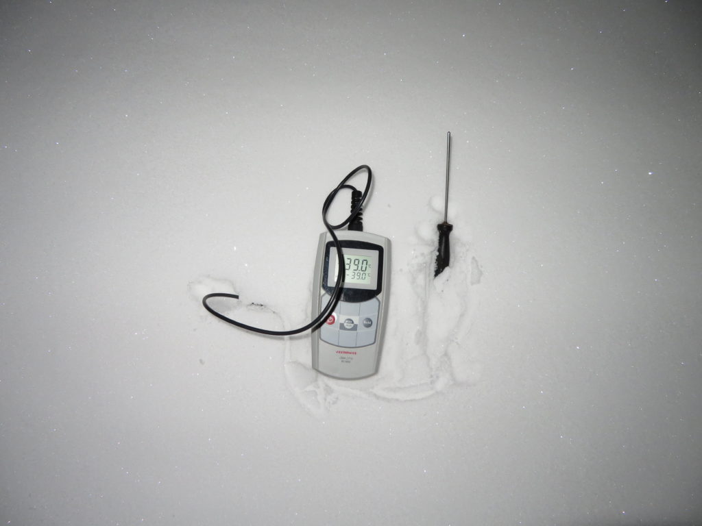
The first part of the night was completely clear and calm, later cirrostratus clouds were invading the sky. Near surface measurement at my camp (dawn). In the basin must be much colder
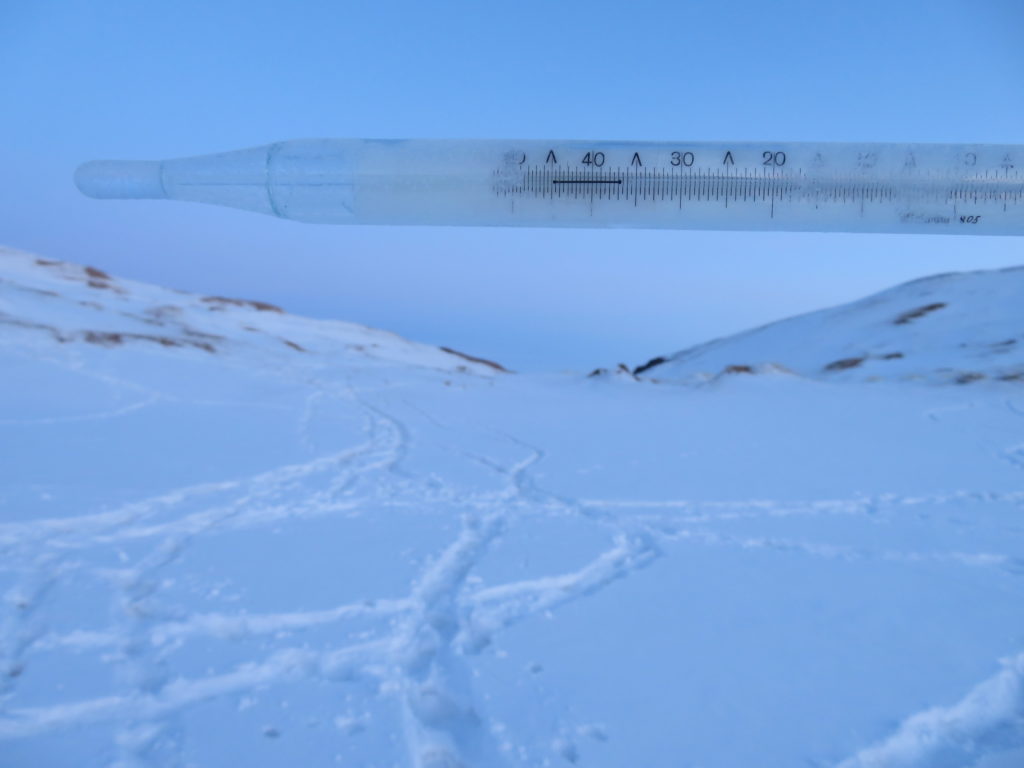
That’s right, went well below -40. Still no wind, but because of the thicker cirrostratus the morning temperature was only -35 degrees
The surface was two degrees colder, very common on the negative topography (convex and inclined terrains can have much more differences)
After 10 AM I started the way back. The tent will remain here, I trust the calm of the anticyclone
My closest neighbor
These are the most tiring parts: steep, snow covered sand. Beside the legs it needs also significant upper body strength
Lunch time
Some parts are completely full with horse and yak trails
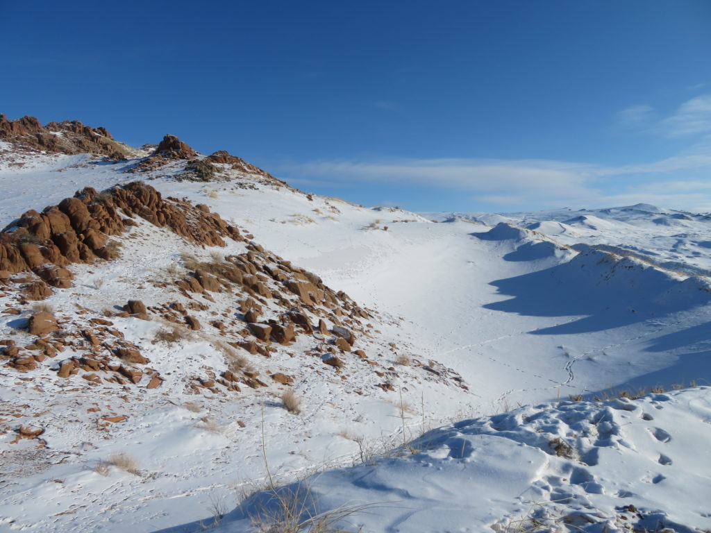
Mukhart’s outer (convex) contour is closer and closer
This view is always welcomed. Now also means that the most difficult part is over
First and last guy seen during the two day trip. He came on horseback to the base of Mukhart, than climbed the abrupt part on foot
He has an efficient style to descend 🙂
I can see the car. Actually I saw it first from the rim of the amphitheatrum
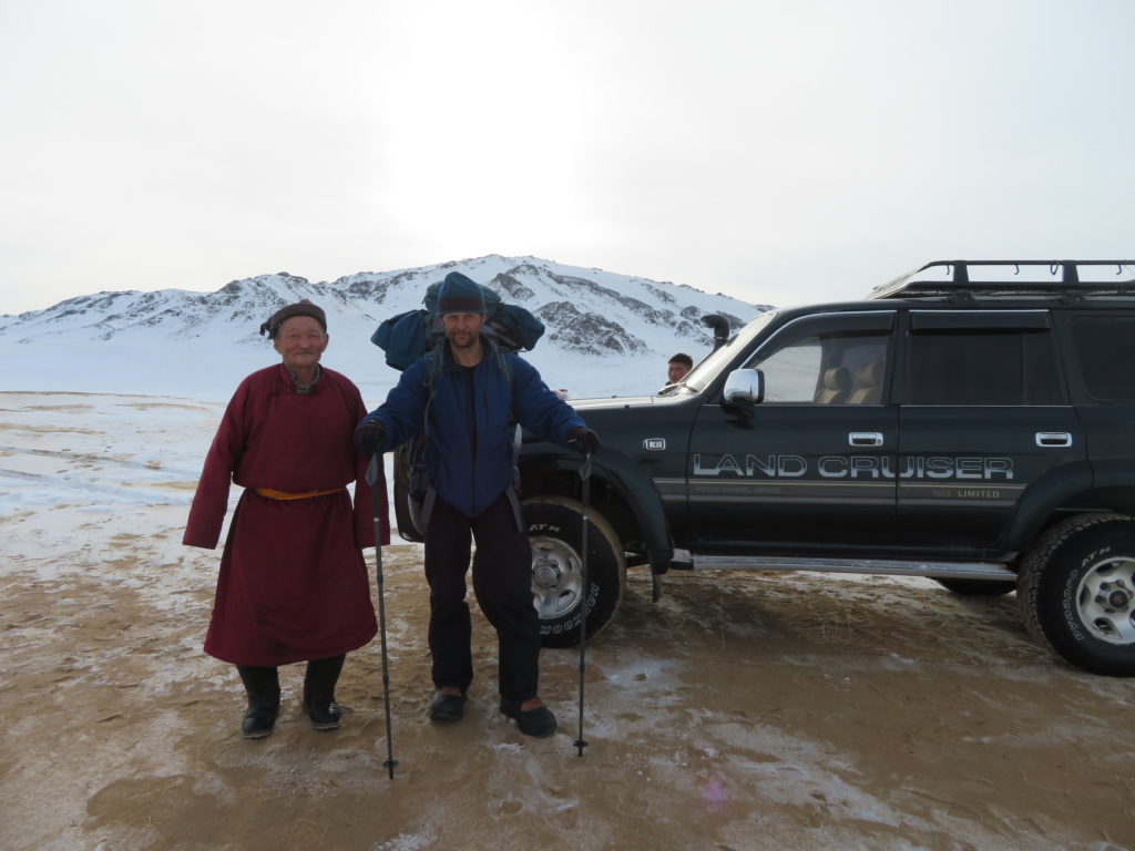
Good to see that the driver is very conscious, coming here much sooner to wait me with warm food
A very rare ocasion here: another car
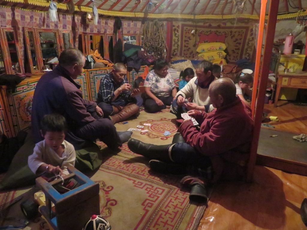
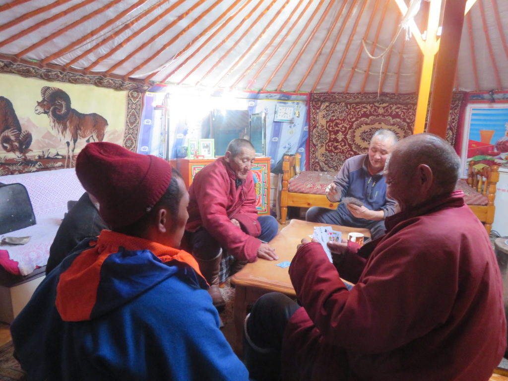
Playing cards is the main program in a yurt. Unfortunately usually accompanied by smoking…
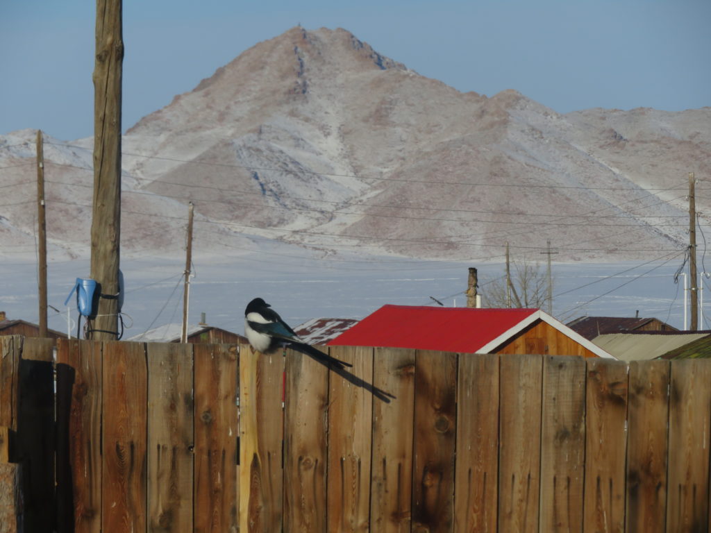
Magpie is the most common bird here in the winter
And I can’t miss out this: Erdenekhairkhan’s weather station
Yurt change the next day: too many children (including an infant) made the essential rest impossible. Sorry guys…
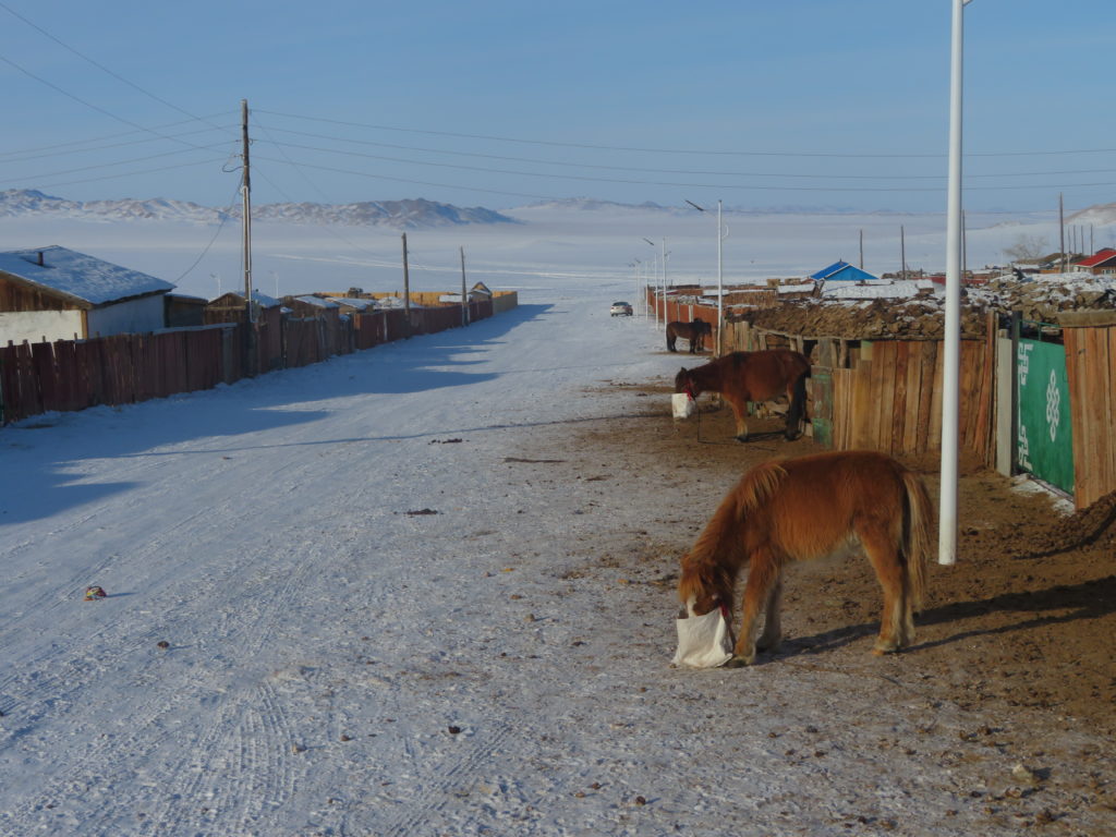
My street
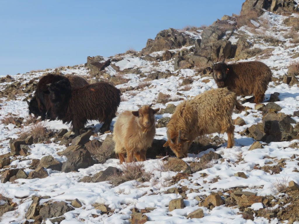
Domestic goats on the hill near the village. Much smaller and with thicker coats than european ones
Yeah, that’s a vulture. Only 100 meters from the settlement
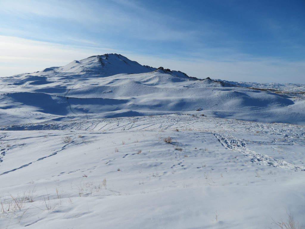
Altan Khairkhan (Golden Holy Mountain), a proeminent landmark
Back to the cards. And smoke. Okay, it’s not that bad
Village center
Traditional lifestyle
Climbing a rocky peak a few km from the settlement. Ibexes are living here…
…but not today
Second research trip: Mukhart again
Much cloudier today, but the following night looks promising
Yaks again, more exemplars this time. The snow partially disappeared from the exposed slopes. Beside the sun and the wind, the animals are also contributing to this, eating it in place of water
I got you!
The backpack is less heavy and I can follow my tracks from the previous trip. Feeling stronger I climbed the rocky peak instead of circumventing it. Worth it
A snow shower started, but it was short and weak
I found my tent moved from its original place. The south-eastern wind carried it inside the neighboring hollow. Maybe a better place to spend the next night, if it’s windy
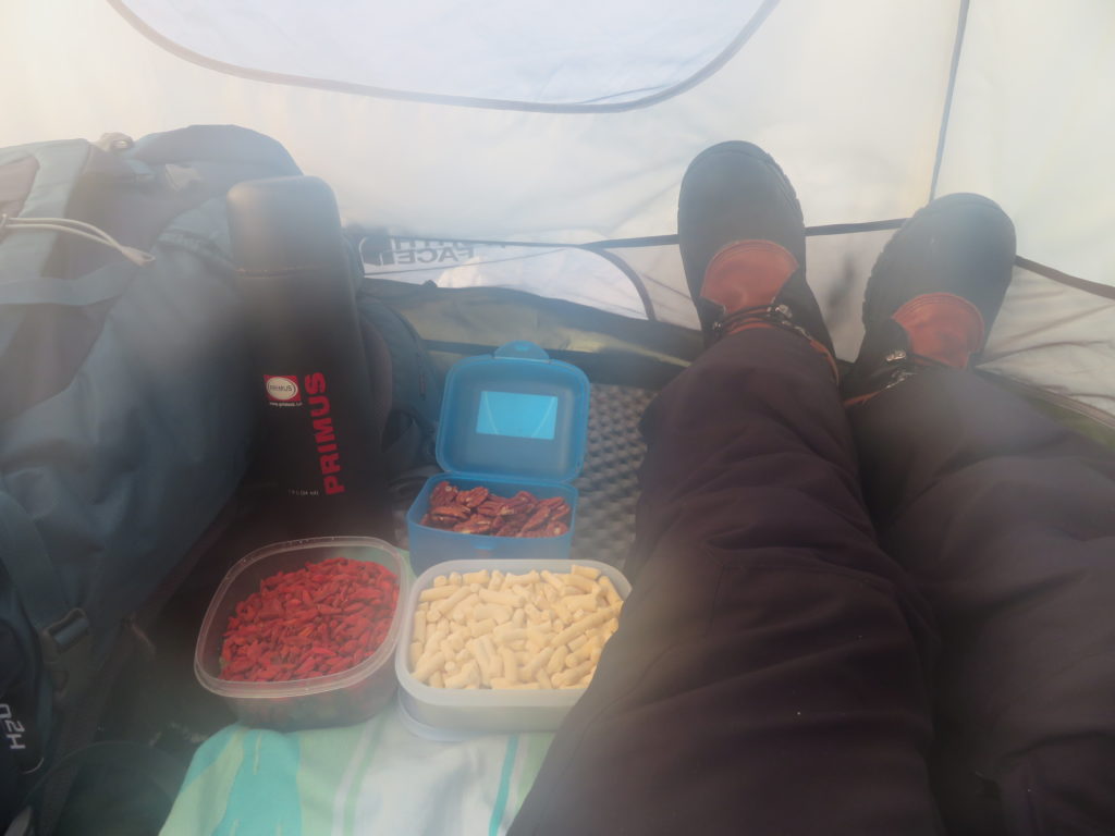
Goji berries, pecan nuts and a local meal “aaruul” (kind of dried yoghurt) is the menu today. Let’s check the tripod with the thermometer
-38.5 degrees for the missing period (13-17 January)
Observing on GoogleEarth, I was curious to see what kind of vegetation is on the slope of the nearby mountain. As I later understood from the locals, this is exactly the “burgas” (bush), which gave the desert’s name
I also made a walk to the northern col (another 1 km in straight line) to measure its elevation (center of image). It was almost the same as GoogleEarth showed: 2221 m. That means the tripod is 27 meters deep inside the basin
This hollow is the actual bottom of the basin (2192 m), but I left the tripod in the original place because of the better sky view factor
Warmer than the first time: -21 degrees in the afternoon
Back to the camp. I’ve moved the tent only a few meters from the place the wind was carrying it. Here is more protected, relatively flat and still not on the hollows bottom
The evening and the first part of the night was fine (clear and calm), but after midnight the wind started to intensify and till the morning completely destroyed the inversion of the basin. Minimum of the night: -40.9 degrees Celsius
Because of the wind I was constrained to pack the tent (it wasn’t able to stay in place even in the hollow). On the way back I met the horses again
The driver was there well before my arrival, this time with the second yurt’s owner
Lunch at the mayor’s house the next day. They heard about my activities and invited me
This time I was lucky and saw the ibexes on the rocky slopes (younger ones)
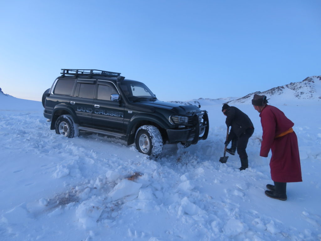
The last research trip started with some difficulty because of the snowdrifts. But we were three and solved the problem soon
Warmer today, very low temperatures are unlikely for the following night
The amphitheatrum have some visitors this morning
I had the strategic advantage observing them from the rim, therefore plenty of time to make pictures
Partially cirrus covered sky today. This setting will continue also in the night
Hind (female deer)
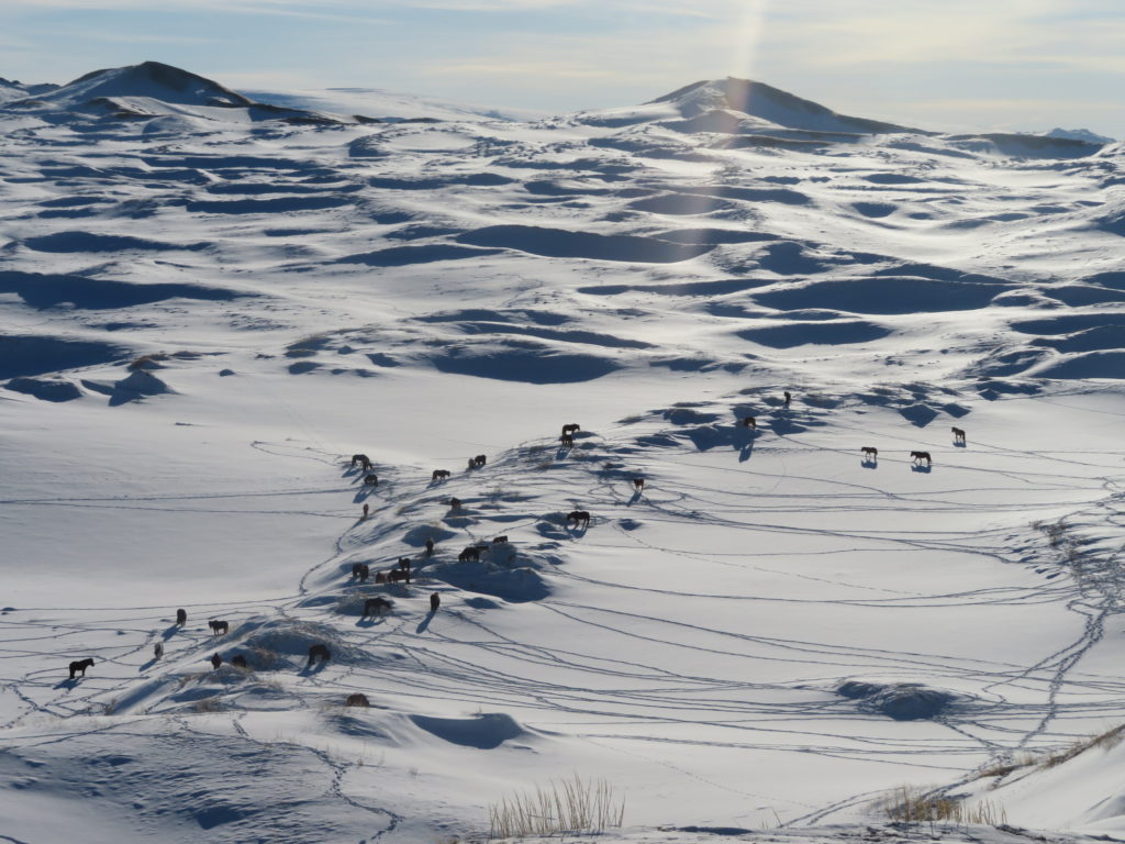
The horses are still in the area
Now it’s calm, I will leave the tent on the ridge again
-39.6 degrees is the minimum for the missing period (18-22 January) and only -16.5 now
I’ve climbed to the highest peak of the western ridge (around 2390 meters) to see Ulaagchiin Khar lake on the other side
View in the opposite direction
The researched basin from the ridge. You can observe the “burgas” vegetation on the mountains slope
-26.3 degrees at dusk. Not very cold, but the decrease was significant (10 degrees in less than two hours). I didn’t slept much this night. Beside that I’ve often checked the sky, wolfs were howling an entire hour in the latter part
And here is the main event of the night and maybe of the entire research: the small hollow beside my tent had -37 degrees (at head level) in the early morning and -39 degrees near the snow surface. That’s a solid 20 degrees lower than the temperature at my camp (only 50 meters away!) where it was -17 degrees. Even weirder is that there was colder in the early evening (-19 degrees), despite the clear and calm conditions during the entire night
The main basin reached -36.8 degrees. That means the small one was the same, actually even slightly colder (!)
This was a characteristic night with generally constant temperature drop. The instant morning temperature was close to the minimum (around -36 degrees)
It’s time to say goodbye to the big…
…and small hollows
Sixth and last time on the same track, became familiar until now
The more exposed parts of the dunes lost the snow cover during the last days
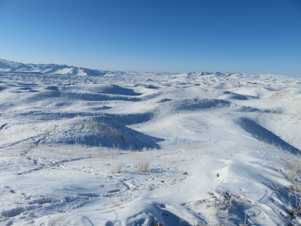
An entire labyrinth of trails in this area
You again
Mukhart for the last time. Remember how white was in the first day?
This wild cereal is very common on the dunes
That’s it guys. Still alive 🙂
The way back to the village…
…and to Donoi airport in the next morning
Otgontenger (4008 meters), the highest peak in the Khangai mountains and one of the most sacred in Mongolia